
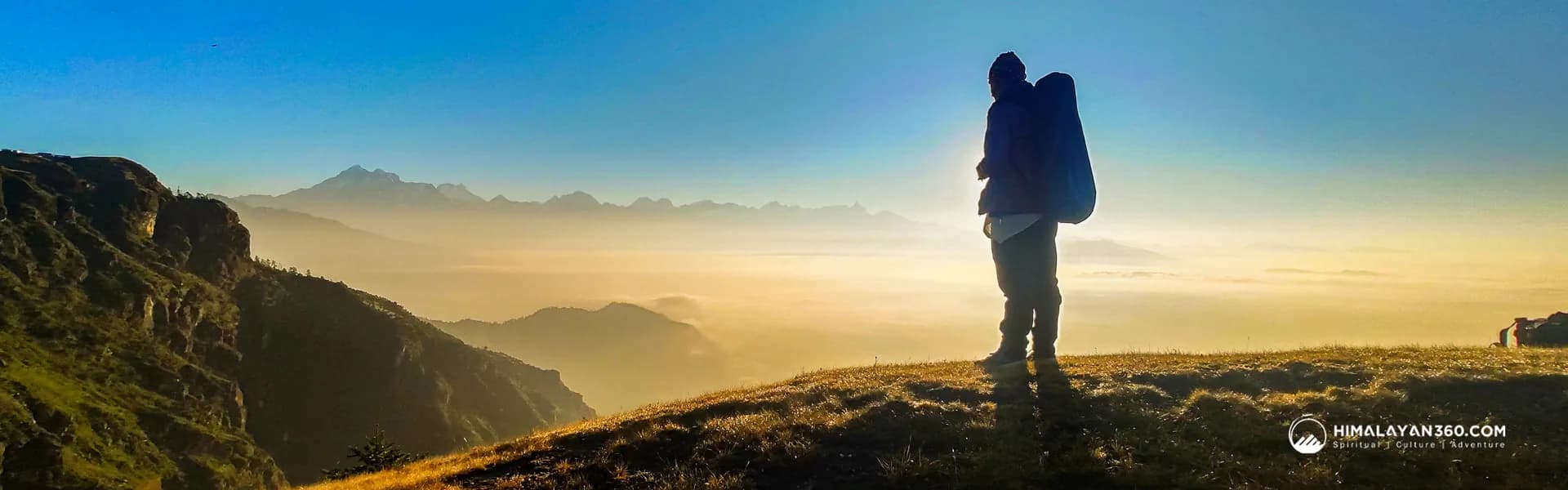
Shree Antu Danda stands at 2,328m on the ridge that Nepal shares with West Bengal, and it is the closest thing eastern Nepal has to a guaranteed sunrise. The practical numbers: it is about 14KM up from Fikkal, about 49KM from Ilam Bazaar, about 59KM from Birtamod, about 65KM from Bhadrapur airport, and about 46KM from Darjeeling across the Pashupatinagar border. Sunrise runs from 04:57 in late June to 06:35 in late December.
You will see the place spelled several ways. Antu Danda, Antu Dada, Shree Antu, Shri Antu and Antu Hill all refer to the same ridge in Suryodaya Municipality, Ilam district. Danda simply means hill or ridge in Nepali, so Antu Danda and Antu Hill are the same words in two languages.
This page is about getting there and timing the sunrise. It is not a package. If you want the whole thing arranged, the itinerary link is further down.
Shree Antu Danda at a Glance
| Altitude | 2,328m at the summit view tower, per the Nepal Tourism Board |
| Where | Suryodaya Municipality ward 4, Ilam district, Koshi Province, eastern Nepal |
| Border | The ridge is the Nepal side of the boundary with West Bengal, India |
| Nearest junction | Fikkal, on the Mechi Highway, about 14KM below |
| Nearest airport | Bhadrapur, about 65KM, 45 minutes from Kathmandu by air |
| From Ilam Bazaar | About 49KM, allow 2 and a half to 3 hours |
| Sunrise | 04:57 in late June to 06:35 in late December, Nepal time |
| Main view | Kanchenjunga at 8,586m, Kumbhakarna, and the Darjeeling hills and Terai plains |
| Population | 5,127 at the 2021 Nepal census |
| Tea under cultivation | 567 hectares in Shree Antu alone |
| Altitude sickness risk | None. This is a hill station, not a high-altitude trek |
Road Distances to Shree Antu from Every Gateway
Almost every search that lands on this subject is really asking one question: how far is it from where I already am. Here are the road distances, all measured to the Shree Antu village and viewpoint area rather than to a district boundary.
| From | Road distance to Shree Antu | What it involves |
|---|---|---|
| Fikkal | About 14KM | The Mechi Highway junction. The Antu road branches off at Chhipitar and climbs from there |
| Ilam Bazaar | About 49KM | Down off the Ilam ridge, southeast along the highway through Kanyam and Fikkal, then up again. Allow 2.5 to 3 hours |
| Birtamod | About 59KM | The Jhapa transport hub. About 47KM of that is Birtamod to Fikkal on the highway |
| Kakarbhitta | About 63KM | The eastern border town opposite Panitanki, and the usual land entry from India |
| Bhadrapur | About 65KM | The nearest airport, and the fastest arrival from Kathmandu |
| Darjeeling | About 46KM | Crosses the international border at Pashupatinagar. Read the border note below first |
| Biratnagar | About 148KM | East along the Mahendra Highway, then north from Jhapa |
| Dharan | About 151KM | Same road as Biratnagar for most of the way |
| Kathmandu | About 500KM | Roughly 12 to 13 hours by road, or fly to Bhadrapur and drive the last 65KM |
How these were measured: road distances come from OpenStreetMap routing between the mapped coordinates for each place, cross-checked against Rome2Rio where both cover the pair. The two agree closely on the legs that matter most, giving 13.4KM and 14.0KM for Fikkal to Shree Antu and 46.3KM and 47.2KM for Birtamod to Fikkal. Treat every figure as approximate. Journey times are not taken from routing engines, because their driving models assume speeds these hill roads do not allow; the times quoted here come from the Nepal Tourism Board and from operator itineraries instead.
The Last Leg: Fikkal to Shree Antu
Every approach converges on the same final stretch, which is why Fikkal to Shree Antu is the query that matters most. Fikkal is a business town in eastern Ilam sitting on the Mechi Highway, surrounded by large tea estates, and it is also the junction for Pashupatinagar on the Indian border. The road to Antu leaves the highway at Chhipitar, just outside Fikkal, and climbs from there.
The good news is that it is blacktopped and takes ordinary vehicles. Jeeps, cars, vans and motorcycles all make it up. The distance is short, roughly 14KM, but it is 14KM of continuous climbing on a hill road, so do not plan around a routing engine's 17 minute estimate. A private jeep will beat that estimate less than you would like, and a shared jeep that picks up and drops passengers will take considerably longer.
Coming up from the plains you pass Kanyam, the tea estate that made Ilam's name more than a century ago and now the most photographed stop on the highway. It is worth building an hour into the day for it rather than treating the drive as pure transit, because Kanyam and Fikkal are on the way to Antu whichever direction you come from.
Getting to Eastern Nepal: Fly or Drive
Ilam is a long way from Kathmandu, and this single decision shapes the whole trip.
By Air to Bhadrapur
Bhadrapur is the airport, and it is about 65KM from Shree Antu. Buddha Air states on its own route page that it operates five daily flights from Kathmandu to Bhadrapur and quotes a flight time of 45 minutes, with its FAQ widening that to 45 to 50 minutes. Yeti Airlines and Shree Airlines fly the same route.
Forty five minutes in the air against twelve hours on the road is not a close contest. If your time in Nepal is limited, fly. The drive up from Bhadrapur then takes the rest of the morning, and you can be at Antu for the following day's sunrise.
By Road from Kathmandu
The road option is roughly 500KM on the shortest routing, and the figure moves around a lot depending on whether you go by the Sindhuli road or the longer Mahendra Highway line through the Terai. What is consistent is the time. Himalayan 360's own Ilam itinerary allows 12 to 13 hours for the Kathmandu to Ilam drive, and independent accounts of the direct bus put it at 14 to 18 hours depending on the service and the season.
Night buses run east from Kathmandu towards Birtamod and Kakarbhitta on the Mahendra Highway, and there are direct services onward to Ilam. If you are riding the bus, Birtamod is the useful place to break the journey, because it is the transport hub where you pick up onward jeeps for Fikkal and Antu.
Coming from Biratnagar and Dharan
Both of these are around 150KM from Shree Antu, which surprises people who assume that eastern Nepal is small. Biratnagar is about 148KM and Dharan about 151KM, and the two routes share most of the same road: east along the Mahendra Highway across Morang and Sunsari into Jhapa, then north off the highway at the Ilam turning.
That is a full day's drive by local transport with changes, or five to six hours in a private vehicle if the highway behaves. If you are starting from either city, the honest advice is to break it at Birtamod or Fikkal rather than trying to reach Antu and see a sunrise on the same rotation of the earth.
Coming from Darjeeling and the Pashupatinagar Border
Shree Antu is genuinely close to Darjeeling, about 46KM by road, and the ridge Antu sits on is the same ridge that runs down from the Darjeeling hills. The route crosses at Pashupatinagar, which the Nepal Tourism Board describes as the eastern border city adjacent to Darjeeling. Pashupatinagar itself is only about 16KM from Shree Antu.
Here is the caveat, and it is a real one. The Nepal Tourism Board's own description of Pashupatinagar says that Indian and Nepali nationals can cross over. Published lists of which Nepali border posts process third country nationals disagree with one another, with some omitting Pashupatinagar entirely and others including it while flagging Kakarbhitta as restricted. That contradiction is not something a travel page should paper over.
So: if you hold an Indian or Nepali passport, Pashupatinagar is the short way in. If you hold any other passport, check the current position with Nepal's Department of Immigration before you commit to it, and plan on Kakarbhitta, about 63KM from Antu, as the crossing you fall back to.
Sunrise Times at Shree Antu, Month by Month
Shree Antu is sold on its sunrise, and the single most common planning mistake is arriving at the viewpoint after it. These times are calculated for the hilltop coordinates at 26.87N 88.14E and given in Nepal time.
| Date | First light | Sunrise | Sunset |
|---|---|---|---|
| 21 March | 05:32 | 05:54 | 18:05 |
| 21 June | 04:32 | 04:57 | 18:50 |
| 23 September | 05:18 | 05:40 | 17:49 |
| 15 October | 05:28 | 05:50 | 17:25 |
| 15 November | 05:47 | 06:10 | 17:03 |
| 21 December | 06:11 | 06:35 | 17:05 |
Three practical points come out of that table.
Be in place 30 to 40 minutes before sunrise. First light arrives roughly 22 minutes ahead of the sun across the whole year, and the colour on Kanchenjunga in that window is the part people remember. Turning up at the listed sunrise time means you have already missed half of it.
October and November are the kindest hours. Sunrise sits between about 05:50 and 06:10, so you are up at five rather than four. In late June you would need to be standing on the hill by about 04:30, which is why the summer sunrise is a much less popular proposition even leaving the monsoon cloud aside.
These are calculated times, not a forecast. They tell you when the sun clears the horizon, not whether you will see it. At 2,328m you are frequently above or inside cloud, and the eastern skyline is real hills rather than a flat horizon, so the sun appears over the ridge a little later than the table says. Give yourself two mornings if the sunrise is the reason you came.
What You Actually See from the Top
On a clear morning the headline is Kanchenjunga at 8,586m, the third highest mountain in the world, with Kumbhakarna and other snow summits along the same wall. The Nepal Tourism Board also notes that on a clear day you can see the middle hills and plains of neighbouring Darjeeling district in West Bengal from Antu Danda, and the Terai plains fall away to the south.
A note on what you will read elsewhere: some pages claim Everest is visible from Antu Danda. The Nepal Tourism Board's own hill stations listing credits the Everest and Makalu view to Sandakpur at 3,636m further north along the same border ridge, not to Antu. Go to Antu for Kanchenjunga and for the sheer breadth of the view over the tea country and the plains, and treat any Everest sighting as a bonus rather than the reason you booked.
The other thing to understand is that Antu is a working landscape, not a viewpoint with a car park. There are 567 hectares of tea garden in Shree Antu and another 123 hectares under cardamom, garlic and other commercial crops. The Lepcha community lives here alongside Limbu, Rai, Magar and Tamang families, and the homestay culture that has grown up on this hill is built around that.
Antu Pokhari, Homestays and What Things Cost
Antu Pokhari is the pond a short way below the viewpoint, and it has become the centre of gravity for the whole destination. According to reporting by Khabarhub in May 2026, the local tourism association counts 110 hotels, cottages and homestays in the area, including 50 community homestays, of which 35 run regular service. The sector directly employs around 310 people.
Visitor numbers run between 800 and 2,000 a day according to the association's leadership, which is a lot of people for a hill this size and explains why booking ahead matters in October and November. Around Rs 50 million has gone into pathways, lighting and accommodation since federalism, and the municipality's tourism revenue has risen from roughly Rs 100,000 a year to about Rs 5.6 million.
On the pond itself, four boats operate, each taking four people, at Rs 50 per person per round. That is the kind of number worth knowing before somebody quotes you something else.
The homestays are the reason to come rather than a compromise. Staying with a family in Shree Antu costs less than a hotel, puts you within walking distance of the viewpoint for a pre-dawn start, and gets you fresh Ilam tea made by the people who grow it.
Best Time of Year to Go
- Autumn, September to November. The clear window. Post-monsoon air gives the best chance of Kanchenjunga, sunrise sits at a civilised 05:40 to 06:10, and the tea slopes are still green. Also the busiest, so book a homestay ahead.
- Spring, March to May. The second window. Sunrise around 05:54 in late March. Warmer and less crowded than autumn, with haze building as the season goes on.
- Winter, December to February. Cold on the ridge and a 06:35 sunrise in late December, which is the most humane wake-up of the year. Clear, sharp air when it is clear at all. Bring more layers than you think a 2,328m hill needs.
- Monsoon, June to August. Cloud sits on the hill and the sunrise is largely theoretical. A 04:57 sunrise means a 04:20 alarm for a view you probably will not get. The tea gardens, on the other hand, are at their most spectacular, so come for the green rather than the mountains.
Putting the Trip Together
If you are assembling this yourself, the shape of it is simple. Fly Kathmandu to Bhadrapur, drive up through Birtamod, Kanyam and Fikkal, turn off at Chhipitar, sleep in a Shree Antu homestay, and be at the viewpoint 40 minutes before the sunrise time in the table above. Add Antu Pokhari and a tea estate to the daylight hours, and reverse the whole thing.
If you would rather not chain the jeeps together yourself, the Ilam Shree Antu Danda tour is the six day version of exactly this route, with Maipokhari and an Ilam tea factory added on the day between arrival and Antu, and the Bhadrapur flight built into the return. It is the itinerary the 3 hour Ilam Bazaar to Antu figure on this page comes from.
Either way, the distances on this page are the ones to plan against. Shree Antu is closer than eastern Nepal's reputation suggests once you are in Jhapa, and much further than it looks from Kathmandu.
 Trek
Trek By air
 Pilgrimage
 Festivals
 Wildlife
 Luxury
 Yoga
Yoga Food
Food Heritage