Manaslu Base Camp is at 4,800M on the moraine below the Manaslu glacier, 1,270M above the village of Samagaon (3,530M). Trekkers reach it on a day hike from Samagaon, 6 to 7 hours there and back, on the rest day of the Manaslu Circuit Trek. The shorter walk on the same day is to Birendra Lake (3,691M), the glacial lake at the foot of the glacier, 1 to 2 hours there and back.
Both walks start and finish in Samagaon, so you sleep at the same teahouse that night. That is the point of the day: you climb high and come back down to sleep, which is what prepares you for Larkya La (5,106M) a few days later. The rest of the trek is covered in the Manaslu Circuit Trek guide.
Manaslu Base Camp Hike from Samagaon
The Manaslu Base Camp hike is a 6 to 7 hour day there and back from Samagaon, climbing about 1,270M to the camp at 4,800M. It is done on the acclimatisation day at Samagaon, after the walk in from Lho or Shyala.
| Start and finish | Samagaon, 3,530M |
| High point | Manaslu Base Camp, 4,800M |
| Climb | About 1,270M up and the same down |
| Distance | About 8KM each way |
| Time | 6 to 7 hours there and back |
| Route | Past Birendra Lake, up a steep grassy ridge above it, then over rock and moraine beside the glacier |
| Food and water | None above Samagaon |
A GPS track recorded in May 2022 measured 16.6KM there and back with 1,253M of climb, a high point of 4,853M, 6 hours of moving time and just over 9 hours in total with stops.
There is nothing to buy above Samagaon, so carry lunch from your teahouse and at least 2 litres of water. Leave after an early breakfast, because the descent is slow and you want to be back before dark.
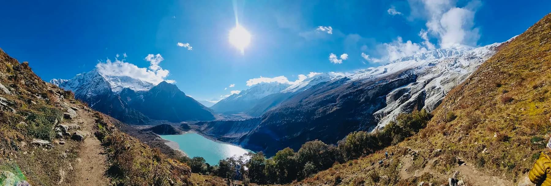
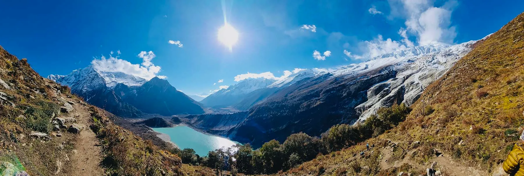 Birendra Lake and the Manaslu glacier from the ridge on the way up.
How High Is Manaslu Base Camp?
Manaslu Base Camp is at 4,800M (15,748FT). The sign put up there by the Manaslu Conservation Area Project gives that figure, and it is the height used on our itineraries.
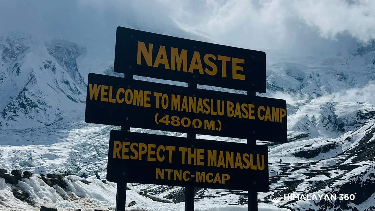 The sign at base camp: 4,800M.
| Place | Height |
|---|
| Samagaon | 3,530M |
| Birendra Lake | 3,691M |
| Pungyen Gompa | About 4,000M |
| Manaslu Base Camp | 4,800M |
| Larkya La | 5,106M |
| Mount Manaslu | 8,163M |
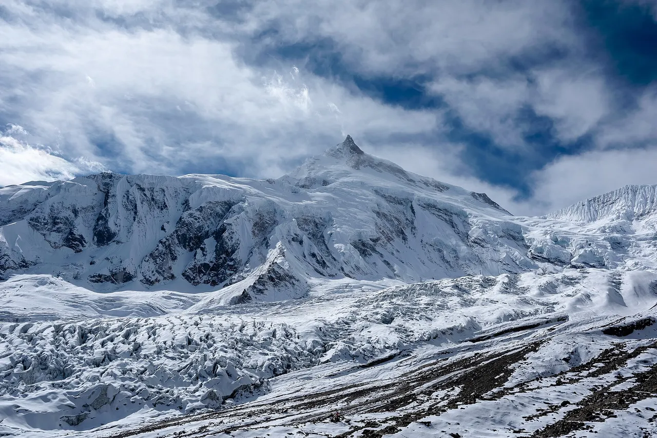
Base camp is the starting point for climbing expeditions on Mount Manaslu (8,163M), the eighth highest mountain in the world, first climbed on 9 May 1956 by Toshio Imanishi and Gyalzen Norbu of a Japanese expedition. In the climbing season the camp is a cluster of expedition tents; outside it there is nothing there but the sign, prayer flags and the glacier.
Birendra Lake
Birendra Lake (Birendra Tal) is a glacial lake at 3,691M, at the foot of the Manaslu glacier, about 45 minutes from Samagaon. It is the short option on the rest day, 1 to 2 hours there and back, and the first stop on the way to base camp.
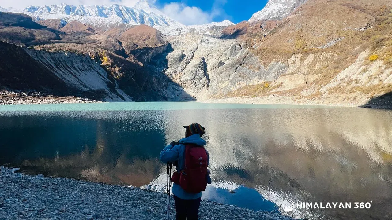
The lake is fed by the glacier above it, and its colour changes with the light from grey to turquoise. It is named after King Birendra of Nepal. The walk is close to level, so it suits a day when you need rest more than height: if your head aches on arrival at Samagaon, this is the walk to choose.
On 21 April 2024 an avalanche dropped ice into the lake and it burst its banks, sending a surge of water down the valley below. No one was hurt, and the lake returned to its normal level. Keep to the trail and away from the shore directly below the glacier.
Pungyen Gompa Day Hike
Pungyen Gompa is a Buddhist monastery at about 4,000M on a plateau below the south face of Manaslu, 5 to 7 hours there and back from Samagaon. It is dedicated to Pungyen, the protector deity the Nubri people believe lives on the mountain.
According to the Manaslu Conservation Area Project, Nubri and Tsumba settlers built the first monastery around 1600. In May 1953, by local tradition, an ice collapse on Manaslu's glacier sent an avalanche onto the plateau that destroyed the original stone monastery and killed 18 people. Villagers in Samagaon blamed the Japanese expedition on the mountain that spring, and in 1954 they turned the next Japanese team back. The monastery was rebuilt, damaged again in the 1934 and 2015 earthquakes, and restored by the community in stone.
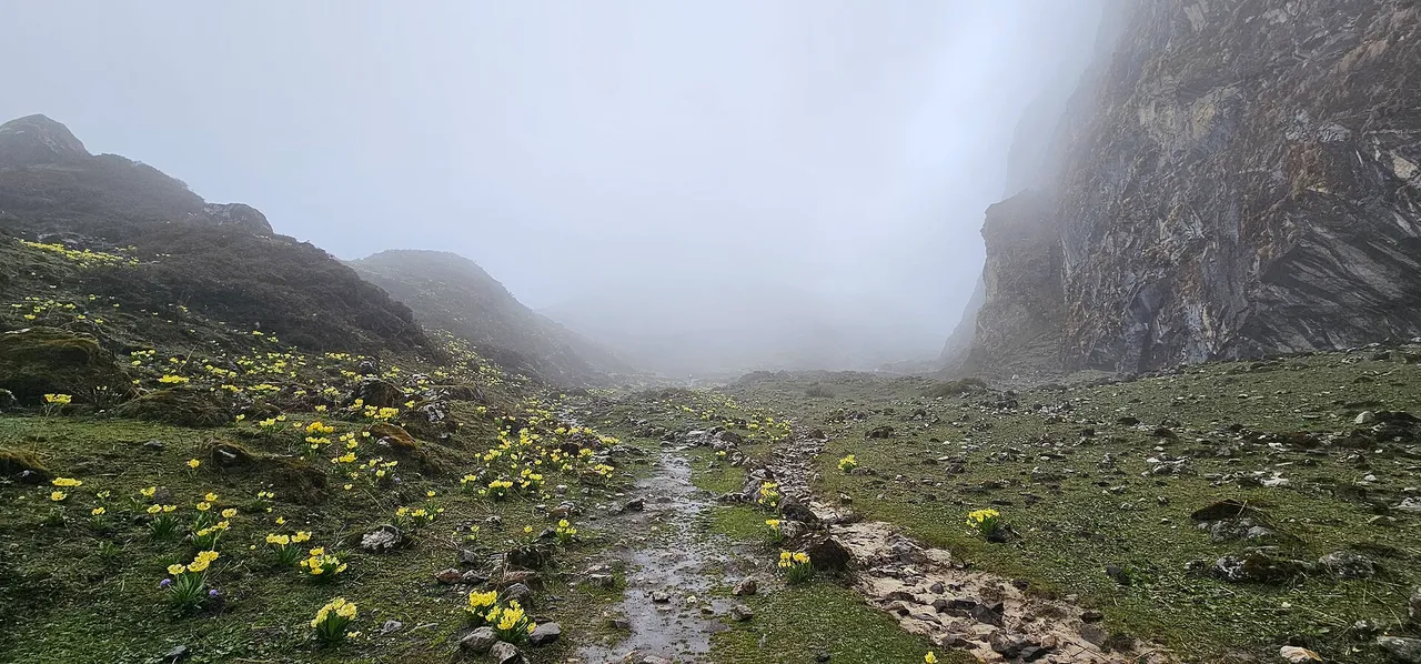
- Height. About 4,000M, close to 500M above Samagaon.
- Time. 5 to 7 hours there and back from Samagaon.
- Facilities. None. No teahouse, shop or water point, so carry everything.
- Inside. Statues of Buddha Shakyamuni, Guru Rinpoche and Pungyen. Walk clockwise around the chortens and mani walls, take your hat and shoes off in the shrine hall, and ask before photographing monks or anything inside.
On our 12 day and 13 day treks, Pungyen Gompa is a detour on the walk from Shyala to Samagaon, which leaves the rest day free for base camp or the lake.
How Hard Is the Manaslu Base Camp Hike?
Hard, but not technical. It is the hardest optional day on the Manaslu Circuit: 1,270M up and the same down, to 4,800M, the day after you arrive at 3,530M. No ropes or climbing skill are needed in spring or autumn.
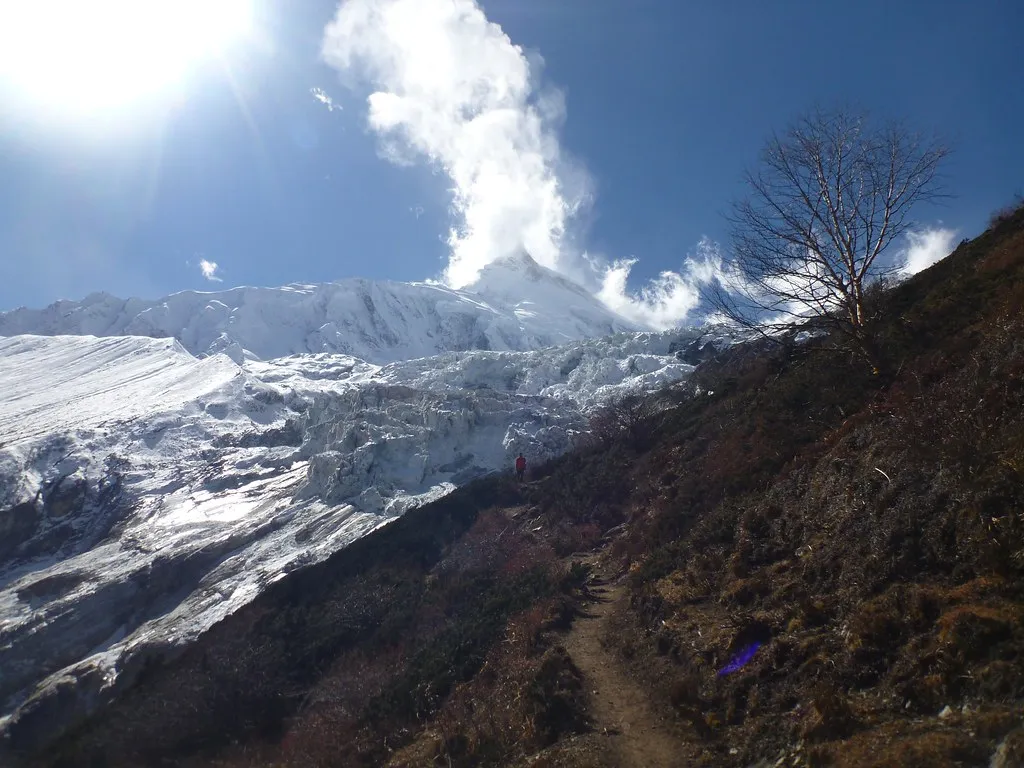
- The ridge above the lake is steep and sustained, and it is the hardest climbing of the day.
- The altitude slows everyone above 4,000M. Walk slowly and stop often.
- The descent is steep and slow, and it is where knees and ankles go. Poles help.
- Snow can cover the upper trail from December to March, and then the last section needs microspikes or is not worth the risk.
You do not have to reach the camp to get the benefit. Climbing a few hundred metres above Samagaon and coming back down to sleep does the acclimatisation work, so agree a turnaround time with your guide before you start and keep to it. Turn back at once if you have a worsening headache, nausea or unusual breathlessness: the day is meant to help you over Larkya La, not end the trek.
Best Time to Visit Manaslu Base Camp
October and November give the clearest days for Manaslu Base Camp, with April and May second. These are the main trekking seasons on the circuit.
| Months | Samagaon day / night | What to expect at base camp |
|---|
| October | 11°C / -1°C | Clear mornings and the sharpest views. Expedition tents at the camp |
| November | 7°C / -6°C | The driest month, and colder |
| December to February | 4°C to 0°C / -9°C to -12°C | Snow on the upper trail; the camp may be out of reach |
| March | 4°C / -7°C | Snow lingers on the ridge early in the month |
| April and May | 7°C to 11°C / -3°C to 2°C | Good walking, with more haze than autumn |
| June to September | 15°C to 17°C / 8°C to 11°C | Monsoon rain on most days and the mountain usually in cloud |
Base camp is about 1,270M above Samagaon, so expect it to be roughly 8°C colder than the village figures, with wind off the glacier on top. Samagaon temperatures are 1996 to 2025 averages from the ERA5 reanalysis, as in the Manaslu weather by month table.
Is There a Separate Manaslu Base Camp Trek?
Packages sold as the Manaslu Base Camp Trek are usually the Manaslu Circuit under another name. They run 14 to 16 days: up the Budhi Gandaki from Machha Khola, a rest day at Samagaon with the hike to base camp, then over Larkya La (5,106M) and down to Dharapani. Some add a second night at Samagaon for Pungyen Gompa.
Base camp has no lodges, so these itineraries reach it the same way as ours: as a day hike from Samagaon, sleeping in the village before and after.
Manaslu Treks That Include the Base Camp Hike
All four of our treks through Samagaon include a full day there for Manaslu Base Camp or Birendra Lake.
Make an enquiry for dates, or read the Manaslu Circuit Trek guide for permits, cost and what to pack.
Photo credits: Mount Manaslu from base camp by Udhabkc and the trail to Pungyen Gompa by Nabin K. Sapkota, both CC BY-SA 4.0; the climb toward base camp by Rick McCharles, CC BY 2.0.
 Trek
 By air
 Pilgrimage
 Festivals
 Wildlife
 Luxury
 Yoga
 Food
 Heritage


