Upper Mustang Trek

Destination

Mustang Region

Max. Altitude

4,280m/14,042ft

Difficulty

HardPhysical training before the trip should begin no later than 2 months before, as you will have a height of 3,000 meters above sea level and more. Hiking is from 6 km daily with an average pace that can be maintained for hours. It is important to have physical fitness & endurance. You will also need the right gear and clothes according to the weather.

Best Season

Feb, Mar, Apr, May, June, Sep, Oct, Nov & Dec

Transportation

Private transfer

Start / End

kathmandu/kathmandu

Accommodation

Tea house

Meals

All Meals (Breakfast, Lunch & Dinner) during the trek

Trek Distance

177.8km/110 miles

Route

KTM-Pokhara-Jomsom-Mustang-Kagbeni-KTM

Travel Distance

553km / 343.6miles

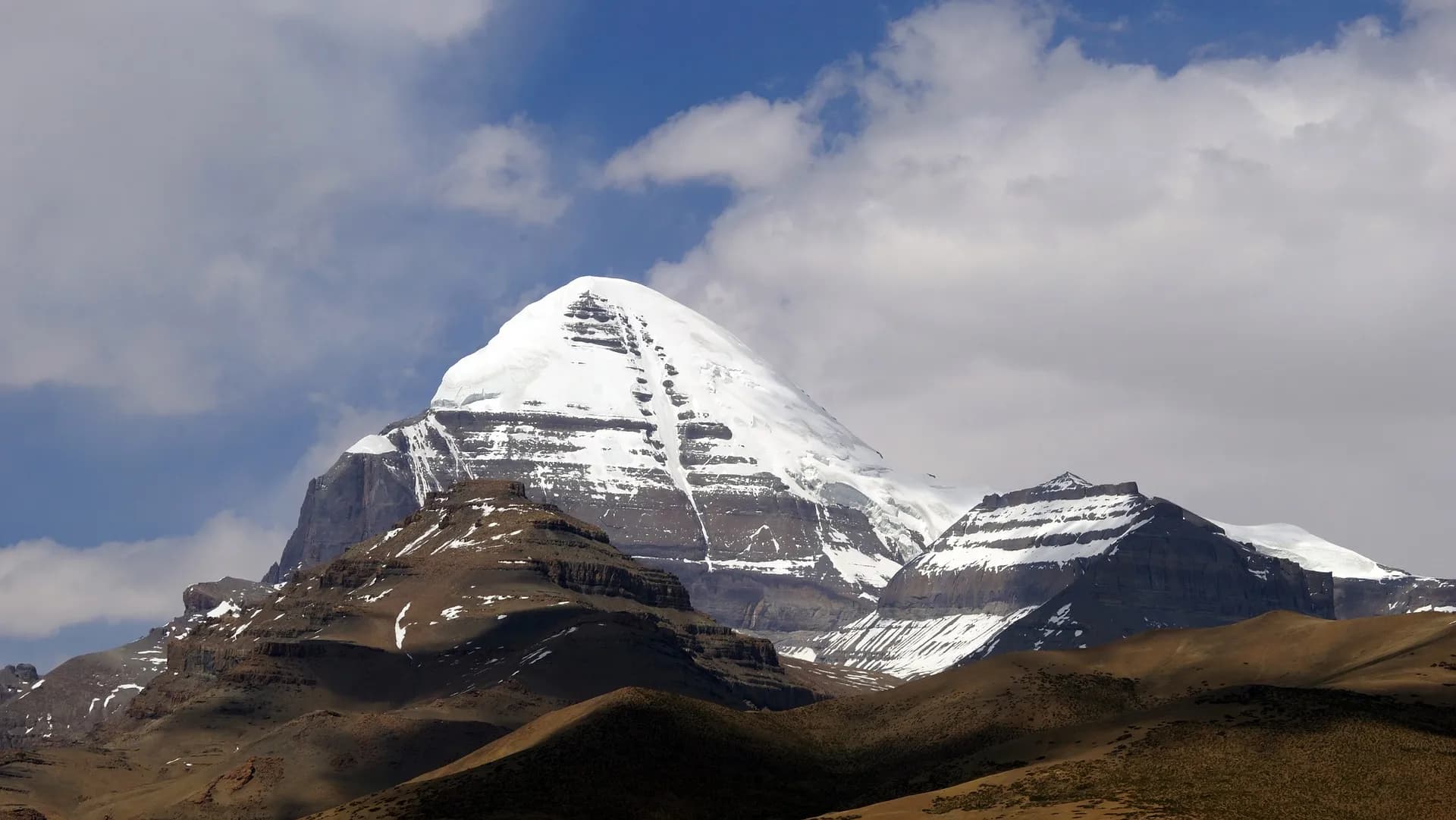
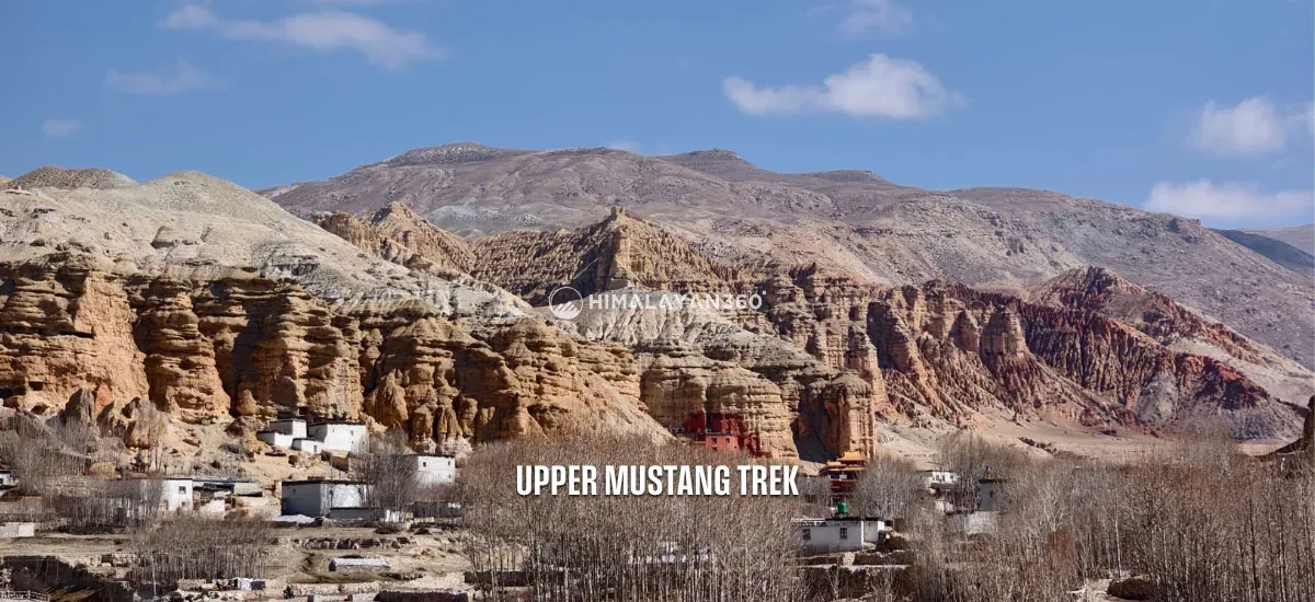
Starting in Nepal, there is a rare journey to the Upper Mustang Trek, leading to the last Forbidden Kingdom called Lo Manthang. Beyond the tall Himalayas and the reach of the monsoon, there lies a dry, desert-like land unlike much of Nepal. The trail was closed to outsiders until 1992, this area hold its old Tibetan culture and mysterious feeling. Along the way, there are ancient caravan trails, fortress villages, and monasteries built on cliffs, making it seem like a place frozen in time.

As you travel through desert-like trails, you’ll pass through age-old villages like Kagbeni, traditional Mustangi homes, and mysterious cave monasteries. The journey winds past terraced fields, hidden valleys, and the banks of the Trishuli and Marsyangdi Rivers. Along the way, take in stunning views of Annapurna, Dhaulagiri, and Manaslu. The stark landscapes are dotted with fossil rocks and sacred chortens. Lo Manthang, a walled city rich in legend and tradition, is at the heart of the trek. This is more than a trek, it’s a walk through living history.

Per Person From

$1,666

16 Days

Experts for help

Ask our travel experts about customising this trip.
Build Your Custom Trip

Per Person From$1,66616 Days

Major Highlights of Upper Mustang Trek

  • Explore Lo Manthang, the walled city known as Nepal’s “Last Forbidden Kingdom,” rich in history and culture.
  • Walk through beautiful villages like Kagbeni, Chele, Syangboche, and Ghami, where traditions are still alive.
  • Trek across dry, open landscapes that feel like part of Tibet, with wide valleys and dramatic hills.
  • Enter a restricted part of the Annapurna region, far from the crowds and full of mystery.
  • Discover unique plants and wildlife that thrive in this high, remote region.
  • Visit ancient caves, monasteries, and historic palaces that tell stories from centuries past.
  • Follow the ancient trade trail across the Himalayas, with its strange rock formations and quiet, dusty paths.
  • Enjoy stunning views of mountains like Annapurna, Dhaulagiri, and Nilgiri along the way.
  • Feel the peaceful energy as you pass prayer flags, stone chortens, and colorful Buddhist sites.

Upper Mustang Trek at a Glance

Distance, walking time and high point for each day
DayItineraryDistance / TimeAltitude
01Arrival at Tribhuvan International Airport in Kathmandu and transfer to hotel (1,400m/4,593ft)1,400 m
02Mustang permit preparation and to Pokhara (820m/2,690ft)road transfer7.3 km1,400 m
03Pokhara to Kagbeni (2,800m/9,186ft)road transfer162 km7 hrs
04Kagbeni to Chele (3,100m/10,171ft)16.8 km6 hrs3,100 m
05Chele to Syangboche (3,800m/12,467ft)21.2 km7 hrs3,800 m
06Syangboche to Ghami (3,510m/11,516ft) via Nyi La Pass (4,020m/13,189ft)19.5 km7 hrs4,020 m
07Ghami to Charang (3,560m/11,680ft)11.5 km6 hrs3,560 m
08Charang to Lo Manthang (3,840m/12,598ft)18 km6 hrs3,950 m
09Exploring Lo-Manthang (day trip to Chhoser Cave)6 hrs3,840 m
10Trek back from Lo Manthang to Dhakmar (3,820m/12,533ft) via Ghar gumba21 km8 hrs4,280 m
11Trek back from Dhakmar to Ghiling (3,570m/11,713ft)18 km7 hrs3,765 m
12Trek back from Ghiling to Chhusang (2,980m/9,778ft)28 km7 hrs3,850 m
13Trek back from Chhusang to Jomsom (2,720m/8,924ft)23.8 km7 hrs3,060 m
14Drive back to Pokhara (820m/2,690ft)road transfer152 km8 hrs2,720 m
15Drive back to Kathmandu (1,400m/4,593ft)road transfer210 km7 hrs2,720 m
16Transfer to the International Airport for your Final Departure
On foot, across 12 trekking days177.8 km67 hrs4,280 m

Reviews from our Guests

From travellers who walked this exact itinerary.

★★★★★

Nyi La Pass at just over four thousand metres and then down to Ghami with those enormous red cliffs. The wind picks up every afternoon so we started early each day. Nothing about this looks like the rest of Nepal. If you have done green Himalayan valleys and want something completely different, go here. Kagbeni at the start is a beautiful old village too.

HS
Hana SuzukiMay 2026
★★★★★

We went in April before the summer crowds and it was cold in the mornings but the light was superb. Chele to Syangboche is a big day with a lot of up and down. The teahouses in Upper Mustang have improved a lot and were more comfortable than I expected. Lo Manthang deserves two nights, not one, so ask for the longer itinerary if you can.

PL
Peter LindqvistApril 2026
★★★★★

The permit for Upper Mustang is expensive and I hesitated. Do not. Walking through the walled city of Lo Manthang and visiting the caves at Chhoser felt like somewhere that had not changed in centuries. The landscape is desert, red and ochre cliffs with white peaks behind. Nikhil arranged for us to see inside two of the old monasteries which we would never have managed alone.

GC
Gabriel CostaOctober 2025 · Guided by Nikhil Nepali
★★★★★

What I loved most is that every day had a new vibe. One day we were walking by Fewa lake in Pohara, the next we were surrounded by monks in a mountain village. The drive never got boring as we were surrounded by the exciting team of Himalayan 360. There was always something to look at or somewhere cool to stop. Also, our guide was super chill and knew all these small facts that made places more interesting. You know how I love random facts and that's why I was soaking it up the whole time. It was such a full experience. I still remember each and every feeling I got till this date.

Verified purchase

CR
Casey RiversAugust 2025 · Guided by Binod Poudel
★★★★★

Bro, the Mustang region doesn't even look real. There are cliffs and crazy patterns, ancient walls, and barley fields in the middle of nowhere. I felt like I was driving through a National Geographic episode. What's crazy is even the small details stuck with me. Yaks walking past our jeep, the wind howling through the passes, little kids waving from stone houses. I thought it was going to be just temples and monasteries, but it was way more than that.

Verified purchase

JB
Jordan BlakeAugust 2025 · Guided by Nabaraj
★★★★★

I recently had the pleasure of embarking on a remarkable journey to Upper Mustang Trek with Himalayan 360, and it's safe to say that this trip exceeded all expectations. From start to finish, it was an experience of a lifetime. Highly recommended. General: We did the trek in the middle of September 2022. We also tried to get in contact with the Manager and send him this text first, but the only feedback we got was that he wanted to talk (As we already did a lot of times) so no feedback at all on our review. First things first we had a great time even 9 of 10 days walking were with rain. The trip/trek itself was well organised and we had a really good time during the trek. Transport: It was really comfortable to have a 4x4 straight from Thamel to Macha Khola and we were happy to choose this option. Going back from Dharapani to Beshisahar with a shared 4x4 was fine. Only point here, our lagguage where lying in a sauces of dirt back in the trunk. Luck for us we had the raincover on those bags. From Beshisahar we were expecting a shared option, which is also mentioned in the contract but the agency took the cheapest options which was the local public transport. We had to change 3 times till Pokhara it was exhausting. Guide: Aang was a really good guide. We learnt a lot about fauna, flora and got a overview about the Buddhism. He was super organized and answered all our questions. The porter was also super nice. Both did a fantastic job. Food and accommodations: The accommodations where all ok. Few where in bad condition, especially the first one (Machha Khola) was a bit ugly. Food was all in all good and the portions where huge. All chefs and hosts made the most of the hospitality. Information: We got no cost details just summary of the total costs. Even based on our request we did not get closer informations. We did not have the chance to compare with other because we felt pushed to sign the contract asap. Trip worth: It was totally worth to to do Manaslu trek instead for example Annapurna. Since there would be a lot of cars on the route. We are happy we chosen Manaslu over Annapurna. Value of Money From our point of view it was too expensive to do this. The agency took too much compared to other groups on the same trek. Sometimes they had even with better conditions. Another couple, they had 2 nights included in Kathmandu + private lift from and to the trek (going back to pokhara as well) the costs where 2/3 of the price we payed. As we also did not have any details from about the costs, it was hard to see where all this money went. We also got a bit a overview how much a guide and porter will take for such trip. The agency organised a accommodation in Pokhara which we paid extra. It was the „Queens Park“. It was not value the money we spent and a bad recommendation. The room was not clean and we had a lot of mold in the bathroom and on the curtains. Overall the rooms where in bad shapes as we even changed ones. Remarks We felt pushed and a bit forced to buy and sign the contract and we did not have the chance to compare to some other companies. The tour operator even said that nowadays big companies just bought small agencies to earn their reputation. We highly recommend to compare other agencies and operator for prices. Other The thing with the walking poles and additional equipment for the trek was quite annoying as we could just simply buy stuff in Thamel but he promised us to give us everything which was missing from our side. Mainly there was the sleeping bag and the poles. We got four different poles and only three worked. One was completely garbage. The sleeping bags wehre quite smelling and they did not feel as washed as we expected. Last but not least, everything worked out as planned, everything was well organised and in place when we needed it. 🙏1

Verified purchase

SB
Shreeya BudhathokiAugust 2024

Upper Mustang Trek Day By Day Itinerary

Download this itinerary

Day 01: Arrival at Tribhuvan International Airport in Kathmandu and transfer to hotel (1,400m/4,593ft)

Itinerary Details
Itinerary FactDetails
Highest Altitude:1,400m/4,593ft

As soon as you land at Tribhuvan International Airport, our representative will welcome you with a Khata. From there, you’ll be comfortably transferred to your hotel in our private vehicle without stress or hassle. Rest for a while, then we’ll gather to discuss the daily travel planning.

The rest of the time, you can explore around the streets in Thamel to shop for last-minute gear, enjoy local food, or immerse yourself in the ambiance. Or you can also visit nearby places like Kathmandu Durbar Square and Swoyambhunath Stupa for a quick cultural immersion.

Itinerary Details
Itinerary FactDetails
Accommodation:3 Star Hotel

Day 02: Mustang permit preparation and fly to Pokhara (820m/2,690ft)

Itinerary Details
Itinerary FactDetails
Time:11-14
Travel Distance:7.3km/4.5miles
Flight Hours:25 mins
Highest Altitude:1,400m/4,593ft

Attraction of the Day: Lakeside

On the second day, you will have breakfast at the hotel and make preparations for the restricted permit. Since the Upper Mustang is restricted, you’ll need a restricted area permit (RAP) to trek there. After getting the permit, we will drive to Tribhuvan International Airport’s domestic terminal in the afternoon and take a 25-minute flight to Pokhara.

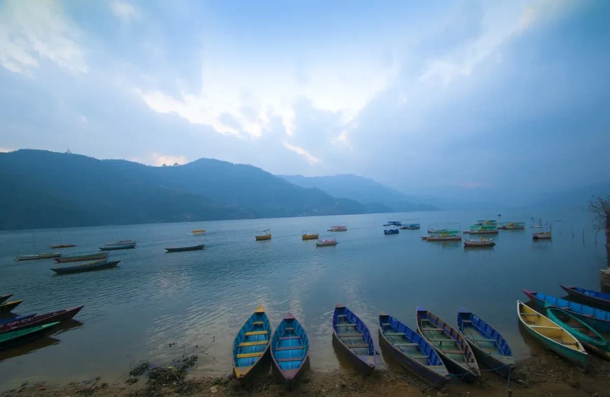
During the flight, if weather favor you can view beautiful mountain vistas of Annapurna, Machhapuchhre (Fishtail), and Dhaulagiri, so make sure to capture them. After landing, we will check in at a 3-star hotel in the Lakeside area for an overnight stay. Later in the evening, explore the area and enjoy boating on Fewa Lake. And if you’re not ready to call it a night, step out into Pokhara’s nightlife, where street musicians and open-air cafés create the perfect evening buzz.

Itinerary Details
Itinerary FactDetails
Meals:Breakfast
Accommodation:3-star hotel

Day 03: Drive from Pokhara to Kagbeni (2,800m/9,186ft)

Itinerary Details
Itinerary FactDetails
Time:07-14
Travel Duration:7 Hours
Travel Distance:162km/100.6miles

Highest Altitude of Day: 2,800m/9,186ft (Kagbeni)

Our morning begins early on this day. We will have breakfast and go on a scenic drive to Kagbeni passing through diverse landscapes, charming countryside areas, picturesque terrace farms, lush valleys, and river banks. We also can get a clear view of the mountain ranges in the distance. The winding road becomes more rocky and off-road after passing by the Beni Bazaar.

From there, we will ride by the Kali Gandaki River and then follow the world’s deepest gorge, the Kali Gandaki Gorge. After we pass Jomsom, the trail becomes more desert-like and dry. The lush vegetation becomes sparse as we move ahead. After a drive of around 7 hours, we will reach Kagbeni village. It is an ancient village of Mustang and a gateway to Upper Mustang. We will stay overnight here.

Itinerary Details
Itinerary FactDetails
Meals:Breakfast, Lunch, and Dinner
Accommodation:Tea House or Lodge

Day 04: Trek from Kagbeni to Chele (3,100m/10,171ft)

Itinerary Details
Itinerary FactDetails
Time:08-14
Trek Distance:16.8km/10.4miles
Ascent:380m/1,247ft
Descend:80m/262ft
Trek Duration:6 Hours
Highest Altitude:3,100m/10,171ft

Our trekking journey to Upper Mustang officially begins from Kagbeni. As we leave the village, we must show our Upper Mustang permits at a checkpoint. From this point on, we step into a part of Nepal that only a few get to explore: the ancient, mysterious kingdom of Mustang. We will trek alongside the eastern bank of the Kali Gandaki River to reach Tangbe. Here, you’ll see unique rock formations and red sandstone pillars. Fun fact, they’re natural.

From Chhuksang, we cross a small river and leave the Kali Gandaki Valley behind. The path gets steeper, with rocky terrain guiding us upward toward Chele. The change in scenery is as rewarding as the climb itself: raw, rugged, and rich with a sense of ancient history. Then, we end the day in Chele, where a warm meal and mountain hospitality await.

Itinerary Details
Itinerary FactDetails
Meals:Breakfast, Lunch, and Dinner
Accommodation:Tea House or Lodge

Day 05: Trek from Chele to Syangboche (3,800m/12,467ft)

Itinerary Details
Itinerary FactDetails
Time:08-15
Trek Distance:21.2km/13miles
Ascent:900m/2,953ft
Descend:160m/525ft
Trek Duration:7 Hours
Highest Altitude:3,800m/12,467ft

After breakfast at Chele, we will continue with our trek. The trek difficulty will slightly increase as we ascend and descend on varied steeper and more rugged terrain. Regardless, we will gradually make our way through the massive eroded canyons to Eklo Bhatti. En route, we can witness breathtaking views of Damodar Danda, Ramchung Cave, Tilicho Peak, and Yaskawa Kang. Then, we will cross the Taklam La mountain pass and Dajori Pass successively.

Just before we start going downhill, we pass the colorful Rangchyung Chorten. It is painted in red, yellow, white, and black, so it naturally stands out in the quiet, dry landscape like a spiritual sign. After this, we walk down to the peaceful Samar village, then cross a small stream at the bottom of the valley. From there, we climb up again through juniper forests and small bushes. After some ups and downs, we finally reach the quiet village of Syangboche, set deep in the valley. We will spend the night here, resting in the peaceful beauty of Mustang.

Note: As we ascend above 3,800m today, please stay well-hydrated, proceed slowly, and inform your trek guide if you experience any discomfort. The itinerary is paced to allow gradual altitude gain; however, if you want a rest day, you can take it.

Itinerary Details
Itinerary FactDetails
Meals:Breakfast, Lunch, and Dinner
Accommodation:Tea House or Lodge

Day 06: Trek from Syangboche to Ghami (3,510m/11,516ft) via Nyi La Pass (4,020m/13,189ft)

Itinerary Details
Itinerary FactDetails
Time:08-15
Trek Distance:19.5km/12miles
Ascent:345m/1,132ft
Descend:635m/2,083ft
Trek Duration:7 Hours
Highest Altitude:4,020m/13,189ft

After breakfast in Syangboche, we start climbing steadily toward Nyi La Pass, one of the higher points on the Upper Mustang route. The trail opens up to wide, dry landscapes, featuring rolling hills, deep-cut valleys, and distant snow-capped peaks. As we gain height, we reach the top where colorful prayer flags flutter in the wind. We’ll pause here to take a moment of peace.

Then, we descend on a winding trail until we reach Ghami, a big village in this area. Ghami is renowned for its ancient monasteries, extensive prayer walls, and traditional Tibetan-style houses. We’ll stay here for the night and soak in the slow, quiet pace of life that makes Mustang feel so special.

Itinerary Details
Itinerary FactDetails
Meals:Breakfast, Lunch, and Dinner
Accommodation:Tea House or Lodge

Day 07: Trek from Ghami to Charang (3,560m/11,680ft)

Itinerary Details
Itinerary FactDetails
Time:08-14
Trek Distance:11.5km/7miles
Ascent:360m/1,181ft
Descend:310m/1,017ft
Trek Duration:6 Hours
Highest Altitude:3,560m/11,680ft

On day 7, we will cross the Ghami Khola before ascending to a plateau to reach our next destination Charang. We will cross the Charang La Pass and come across a long mani wall. It is 250 meters long with Tibetan mantras engraved on it. Similarly, we will also come across several other mani walls as we reach Charang.

As we go deeper, the landscape becomes barren, with no signs of vegetation. Likewise, the population also becomes sparse. The Charang village sits at the top of the Charang Chu canyon, offering a view of rocky hills and snow-capped mountains. It also has a red Gompa with stunning sculptures and a massive medieval fortress. We will rest overnight in Charang village after long day of hike.

Itinerary Details
Itinerary FactDetails
Meals:Breakfast, Lunch, and Dinner
Accommodation:Tea House or Lodge

Day 08: Trek from Charang to Lo Manthang (3,840m/12,598ft)

Itinerary Details
Itinerary FactDetails
Time:08-14
Trek Distance:18km/11miles
Ascent:390m/1,280ft
Descend:110m/361ft
Trek Duration:6 Hours
Highest Altitude:3,950m/12,959ft

Today is an important day for us as we will finally begin our trek to Lo Manthang. We will start by descending from the Charang village to Charang Chu Canyon. En route, we will come across a large isolated chorten. It is a significant landmark that separates Charang from Lo Manthang. Then the trail gradually begins to ascend from here onwards. We will cross a river and then the Lo La Pass, from where we will lay our eyes on Lo-Manthang for the first time.

From the pass, we can also get stunning views of Mount Annapurna, Dhaulagiri, Nilgiri, and other surrounding peaks. We will continue trekking until we reach Lo-Manthang, the capital of the ancient Kingdom Lo. It’s home to the Lo people, who still proudly carry on their unique culture. We’ll see high walls around it, guarding the city and its historic landmarks. Upon entering the city, you can sense a strong Tibetan influence in its buildings, monasteries, and way of life.

Itinerary Details
Itinerary FactDetails
Meals:Breakfast, Lunch, and Dinner
Accommodation:Tea House or Lodge

Day 09: Exploring Lo-Manthang (day trip to Chhoser Cave)

Itinerary Details
Itinerary FactDetails
Time:08-14
Trek Duration:6 Hours
Highest Altitude:3,840m/12,598ft

Today, we will spend our day exploring Lo-Manthang. After breakfast, we will visit Chhoser Cave, also known asJhong and Sky Caves. It’shistory dates back 2,500 years. These are five-story man-made caves built into the cliffs. It is impossible to determine why or who created these caves. Some researchers believe that these caves are burial chambers. Meanwhile, others believe that these caves serve as hiding places or are used for meditation.

After exploring cave, we will return to explore the village while taking in the stunning views. You can visit various cultural landmarks and heritages like the Lo Manthang Royal Palace, Jampa Lhakhang, Thubchen, and other monasteries. You can also experience the local culture and customs of the residents, who follow the Bonpo form of Tibetan Buddhism. We will stay another night at Lo Manthang.

Itinerary Details
Itinerary FactDetails
Meals:Breakfast, Lunch, and Dinner
Accommodation:Tea House or Lodge

Day 10: Trek back from Lo Manthang to Dhakmar (3,820m/12,533ft) via Ghar gumba

Itinerary Details
Itinerary FactDetails
Time:07-15
Trek Distance:21km/13miles
Ascent:690m/2,264ft
Descend:710m/2,329ft
Trek Duration:8 Hours
Highest Altitude:4,280m/14,042ft

On the tenth trek day, it is time to bid goodbye to Lo Manthang and begin our descent to Dhakmar. We will leave the walled city and start with a steep ascent to Chogo La. This pass stretches through the area and is challenging but adventurous. Then, we will gradually begin following the trail to Lo Gekar. In Lo Gekar, there is the world’s oldest Tibetan monastery, Ghar Gompa. The monastery was built around the 7th century and houses beautiful rock paintings.

We will continue trekking and cross the Mui La Pass. Similarly, we will traverse Muila Bhanjyang before reaching the beautiful Dhamkar village. There are numerous cliff caves above the village’s hilltops. We will rest our tired bodies at a tea house in Dhamkar village for the night and have delicious dal bhat dinner.

Itinerary Details
Itinerary FactDetails
Meals:Breakfast, Lunch, and Dinner
Accommodation:Tea House or Lodge

Day 11: Trek back from Dhakmar to Ghiling (3,570m/11,713ft)

Itinerary Details
Itinerary FactDetails
Time:08-15
Trek Distance:18km/59miles
Ascent:445m/1,460ft
Descend:695m/2,280ft
Trek Duration:7 Hours
Highest Altitude:3,765m/12,352ft

We will start our trek early today as srong winds may start blowing in the afternoon. The early morning trail takes us through a dry plateau in a remote landscape. There are very few trekkers on this beautiful trek, so the atmosphere is serene and quiet. We will keep descending while passing small Tibetan Nepali settlements and walled village fields.

The trail takes us past Ghami village, and we will cross the Nyi La Pass again. After conquering the pass for the second time, the trail begins to descend through dry plateau and wind-swept fields. Finally, after an arduous trek, we will reach Ghiling where we will spend our night. If time favors, you can explore this beautiful small village.

Itinerary Details
Itinerary FactDetails
Meals:Breakfast, Lunch, and Dinner
Accommodation:Tea House or Lodge

Day 12: Trek back from Ghiling to Chhusang (2,980m/9,778ft)

Itinerary Details
Itinerary FactDetails
Time:08-15
Trek Distance:28km/17miles
Ascent:440m/1,444ft
Descend:1,030m/3,379ft
Trek Duration:7 Hours
Highest Altitude:3,850m/12,631ft

On this day, we will retrace our steps on familiar trails past Syangboche and enter the lush forest route, welcoming a splash of green after days of rocky desert landscapes. As we reach Samar, the mountains put on another show, definitely the kind that will make you stop mid-step to stare. We’ll continue past scattered villages and quiet valleys, crossing Dajori La and Taklam La once again.

After a rewarding descent, we’ll roll into Chele, and from there, make our way down to Chhuksang, our stop for the night. With the Kali Gandaki River glimmering below and snow-capped peaks in the distance, you’ll forget you’ve been here before because it still feels brand new.

Itinerary Details
Itinerary FactDetails
Meals:Breakfast, Lunch, and Dinner
Accommodation:Tea House or Lodge

Day 13: Trek back from Chhusang to Jomsom (2,720m/8,924ft)

Itinerary Details
Itinerary FactDetails
Time:08-15
Trek Distance:23.8km/14.7miles
Ascent:130m/427ft
Descend:340m/1,115ft
Trek Duration:7 Hours
Highest Altitude:3,060m/10,039ft

After spending the night in Chhuksung, we will continue our descent after breakfast. The trail takes us through Jharkot, a village just above Kagbeni. From here, we will exit the restricted area of Upper Mustang and join the Annapurna Circuit trek trail. As we continue trekking, we will reach the Kagbeni village, which offers stunning views of the Kali Gandaki Valley. We will continue trekking until we reach Jomsom. We will spend the day at a teahouse in Jomsom.

Itinerary Details
Itinerary FactDetails
Meals:Breakfast, Lunch, and Dinner
Accommodation:Tea House or Lodge

Day 14: Drive back to Pokhara (820m/2,690ft)

Itinerary Details
Itinerary FactDetails
Time:08-16
Travel Duration:8 Hours
Travel Distance:152km/95miles
Highest Altitude:2,720m/8,924ft
  • Attraction of the day: local villages, lake side

After breakfast, we will board a jeep to return to Pokhara. The jeep will take us through the desert-like arid landscapes of Mustang to the lush greenery of Pokhara city. The road is rough, gravelly, and bumpy as we slowly drive along the Kali Gandaki River, passing by Tatopani and Beni.

We will see the familiar sight as we drive past charming countryside, rivers, waterfalls, and green forest hills. It can take around 8 hours to get to Pokhara, depending on the road conditions. We will stay at a 3-star hotel overnight. You can enjoy the last day in Pokhara as you please.

Itinerary Details
Itinerary FactDetails
Meals:Breakfast, Lunch
Accommodation:3 Star hotel

Day 15: Drive back to Kathmandu (1,400m/4,593ft)

Itinerary Details
Itinerary FactDetails
Time:08-15
Travel Duration:7 Hours
Travel Distance:210km/130miles
Highest Altitude:2,720m/8,924ft

Today, we will return to the capital city, Kathmandu. We will take an early morning jeep ride from our hotel. The ride on the winding Prithvi Highway passes through beautiful villages, terrace farms, riverbanks, and lush hills. As we leave Pokhara, the mountain views become increasingly distant. It can take 6-7 hours to reach Kathmandu, depending on the road conditions and traffic. You can rest, and we will hold a farewell dinner in the evening. You can shop around Thamel for souvenirs or enjoy the nightlife with the remaining time.

Itinerary Details
Itinerary FactDetails
Meals:Breakfast, Dinner
Accommodation:3 Star hotel

Day 16: Transfer to the International Airport for your Final Departure

It’s final day of the trip. One of our representative from Himalayan 360 will help you transfer to Tribhuvan International Airport two hours before your scheduled flight. We hope you had a memorable time with us and will remember us for future trips. Have a safe flight back home!

Itinerary Details
Itinerary FactDetails
Meals:Breakfast

Upper Mustang Trek Included/ Excluded

Cost Includes

Cost Excludes

Transfer

  • Airport Transfer
  • Kathmandu to Pokhara by Flight
  • Pokhara to Kagbeni by Sharing Local Jeep
  • Jomsom to Pokhara by Public Jeep/Bus
  • Pokhara to Kathmandu by Tourist Bus
  • International flight
  • Domestic flights (ie: Jomsom to Pokhara and Pokhara to Kathmandu)
  • Private transfer during the trek
  • Extra transfer which is not mentioned in itinerary

Accommodation & Food

  • 2 Night Kathmandu in a 3-star hotel (sharing basis)
  • 2 Night in Pokhara 3 Star hotel (sharing basis)
  • 11 nights in Mountain Tea House Lodge (sharing basis)
  • Food: 15 Breakfast, 12 lunch, 12 Dinner
  • Extra night accommodation in Kathmandu due to early arrival or late departure, or early return from the trek
  • Extra nights in Pokhara
  • Extra night during Trekking

Support

  • Government-licensed English-speaking local trek leader
  • Porter to carry bags (2:1porter)

Permit & Insurance

  • Mustang Special region permit
  • Annapurna Conservation Area permit
  • Nepal visa fees
  • Travel insurance that covers emergency high-altitude rescue and evacuation (compulsory)

Others

  • Gov. and local tax and agency service charges
  • Free luggage storage services in Kathmandu
  • Appreciation Certificate after the successful trek
  • Free consulting services before & after trek book
  • Farewell dinner at the end of the trek
  • Staff insurance, salary, equipment, food & clothing.
  • Duffle bag during trek (should return after trek)
  • MEDICAL KIT: Comprehensive Medical kit.
  • Personal clothing and gear and Personal expenses: shopping, snacks, boild water, drinks, hot shower, alcohol, Wi-Fi, calls, battery charging, extra porters, etc.
  • Tips for staff (it is expected)
  • All other costs and expenses not listed in “including”
  • Additional cost: Additional costs incurred due to causes beyond our control, for example weather conditions, landslides, itinerary modifications, illness, government policies change, strikes, etc.

Route & Elevation

01k2k3k4kD1D2D4D5D6D7D8D9D10D11D12D13D14D15 4,280 m
Highest point reached on each day, plotted against distance walked. Metres on the left, day number along the bottom.

FAQs for Upper Mustang Trek

Upper Mustang Trek Information

Difficulty

Upper Mustang is a demanding, high-altitude trek. It requires good health and fitness to conquer the challenging trails. Although prior trekking experience is not necessary, having one helps. The trek is suitable for both beginners and seasoned trekkers, but they must prepare both physically and mentally for the journey.

During the Upper Mustang Trek, you will trek from subtropical, verdant landscapes to desert-like arid landscapes. The winding routes have rough and rugged terrains. As you ascend to higher elevations, the trails become dusty and steeper, and you will mostly trek on loose gravel. Moreover, the average trekking time is 6 hours, which makes the journey physically demanding. The maximum altitude of the Upper Mustang Trek is 4,280 meters. Hence, there is also the risk of altitude-related sickness.

Another factor that makes the trek difficult is the unpredictable weather conditions. Despite the season, they change rapidly at higher elevations. Strong winds are common at the main trekking routes to the Upper Mustang in the afternoon. The temperature also drops significantly at night and in the mornings. There is also a lack of infrastructure along the trekking route. Many trekkers feel mentally stressed due to the changing environment, lack of connectivity, and unfamiliarity. In addition to the physical challenge, the trek can mentally drain you. You can complete the Upper Mustang Trek successfully with proper preparation, the right gear, and adherence to the safety guidelines.

Best Season & Packing List

The best time for the Upper Mustang Trek are spring (March–May) and autumn (September–November). These seasons have the best weather and climatic conditions. Take a look at the brief of each season:

Autumn (September to November)

Autumn is one of the most suitable times for trekking in Nepal. The weather is clear and consistent, with warm temperatures ranging from 12°C to 20°C during the day and from -8°C to -4°C at night. The skies are clear, hence you can get excellent views of the mountains and minimal rain. The lower areas have autumn leaves decorating the trekking routes even more beautifully. Since more people trek in autumn, so it is wise to reserve your accommodation and transportation in advance.

Spring (March to May)

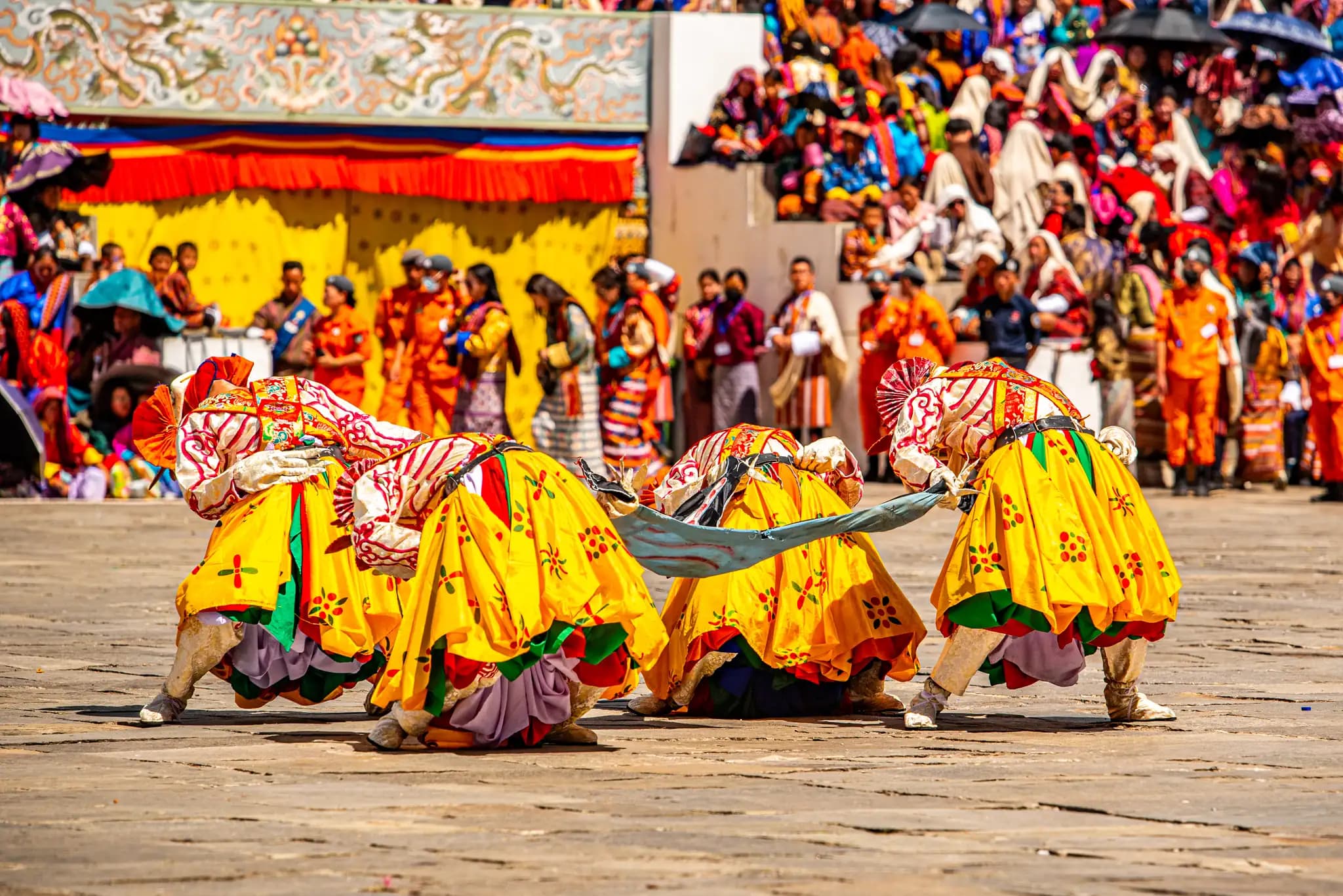
Spring is another great time for the Upper Mustang Trek. The weather is pleasant, with daytime temperatures between 16°C and 22°C, and nights just a little chilly, sometimes dipping below zero. The trails come to life with colorful blooms and active wildlife, making the journey feel fresh and full of energy. Plus, if you trek in May, you might catch the Tiji Festival in Lo Manthang. This festival lasts three days, featuring masked dances, ancient rituals, and a festive atmosphere. It’s a rare chance not just to see Upper Mustang, but feel its culture come alive. Nature’s at its best, locals are celebrating, and you’re right in the heart of it all.

Summer (April to June)

While most of Nepal receives heavy rainfall during the monsoon, Upper Mustang remains mostly dry, thanks to its location in the rain shadow of the Himalayas. So, while the lower trails in Nepal are often muddy and humid, this region remains a reliable escape, offering clearer skies and drier paths. Daytime temperatures range from 16°C to 25°C, and nights can dip to around -3°C to 0°C, making it quite comfortable for high-altitude trekking. The rainfall that reaches lower regions brings lush greenery and cleaner air, giving the surrounding hills a fresh, vibrant appearance as you travel north.

If you’re looking to avoid crowds and still enjoy dramatic desert landscapes, summer is actually one of the best time to trek in Mustang. You get the best of both worlds, monsoon-cleansed views below and dry, dramatic terrain above.

Winter (December to February)

Winter in Upper Mustang brings extreme cold, heavy snow, and limited services. Most locals leave Lo Manthang for lower altitudes, and many lodges close during this time. As a result, we do not recommend trekking to Upper Mustang in winter.

0 of 26 packed

Clothing & Footwear

Equipment & Gear

Miscellaneous

Weighing It Against the Alternatives

If you are still deciding, this is how Upper Mustang Trek sits against the trips people most often weigh it against — on days, distance, difficulty and cost.

This trip compared with the alternatives
TripDays / DistanceDifficultyFrom
Upper Mustang Trekthis trip16 days177.8 kmHard$1,666
Everest Two Passes Trek16 days132.54 kmStrenuous$1,410
Island Peak Climbing 16 days102.5 kmStrenuous$1,945
15 days Tsum Valley Trek15 days147.2 kmMedium$965
Everest Cho La Pass Trek17 days132.54 kmStrenuous$1,410

More trips like Upper Mustang Trek

$1,666 per person

Himalayan360Everything there is to do in the Himalayas

  • AdventureTrek the Himalayas, fly over them at sunrise, land at base camp, drift across the lake at Pokhara
  • CulturalLearn Kathmandu’s temples, eat your way through the city, sit at a festival in Bhutan
  • SpiritualRoll out a yoga mat on the trail, walk to Muktinath, cross Tibet to Kailash

Every path, Himalayan360 has you covered.

Trip Planner