Manaslu Circuit Trek at a Glance
| Walking distance | 143.7KM / 89 miles |
| Duration | 10 walking days, 14 day standard package |
| Highest point | Larkya La Pass, 5,106M / 16,752FT |
| Start and finish | Machha Khola (930M) to Dharapani (1,820M) |
| Difficulty | Strenuous, non technical |
| Longest day | Dharamsala to Bhimtang, 24.8KM, 9 hours |
| Best months | October, then April |
| Permits | MRAP, MCAP and ACAP. About USD 144 September to November |
| Guide | Compulsory. Solo permits allowed since March 2026 |
| Package price | From USD 920 per person |
| Accommodation | Teahouses throughout, unheated rooms |
Highlights of the Trail
The Manaslu Circuit is a cultural trek as much as a mountain one. The lower valley is Gurung and Hindu; from Deng upwards it is Tibetan Buddhist, and the people of the upper valley are Nubri, with the Tsumba in the side valley to the east.
- Mount Manaslu, 8,163M. Seen properly for the first time from around Lho, and dominating the walk from Shyala to Samagaun.
- Pungyen Gompa. A monastery on the Pungen glacier above Samagaun, named for the mountain itself, and the best half day walk on the trek.
- Manaslu Base Camp, 4,800M, and Birendra Lake, 3,691M. The Samagaun rest day walk, and the closest you get to the mountain.
- Samdo. The last permanent village, settled by Tibetan refugees, with the old trading route to the border above it.
- Larkya La, 5,106M. Prayer flags at the top and the whole Annapurna range opening up on the far side.
- The Budhi Gandaki gorge. Waterfalls, cut rock stairways and a river you cross more times than you can count.
How Hard Is the Manaslu Circuit Trek?
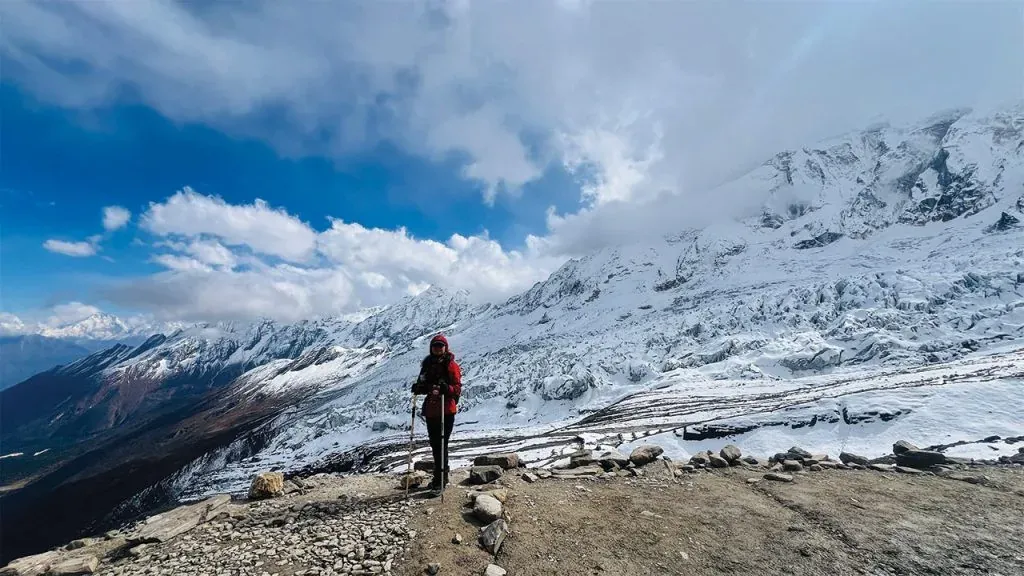
Strenuous, and not technical. No ropes, crampons or climbing skill are needed on the standard route in spring or autumn. What the trek asks for is the plain kind of endurance: walk a long day, sleep badly at altitude, get up and do it again for two weeks.
Six things make it hard. None of them is a skill you have to learn first.
- Ten walking days in a row. Most of them 6 to 8 hours, broken only by the rest day at Samagaun.
- Sustained altitude. Every night from Lho onwards is above 3,000M. Dharamsala at 4,470M is the last stop before the pass, and altitude sickness is the most common reason people turn back.
- The Larkya La crossing. The longest day of the trek, gaining 646M to the pass and then dropping steeply into the Marsyangdi valley.
- Cold. Near the pass it reaches -20°C even in season, and nothing above Samagaun is heated.
- Remoteness. There is no road between Machha Khola and Dharapani and no vehicle can reach you. A helicopter is the only way out.
- Terrain that keeps changing. River gorge, then forest and farmland, then moraine and scree above Samdo. Each change resets the pace you had settled into.
The single hardest thing about it is not any one day. It is the accumulation: by Samdo you have been walking for a week, sleeping badly for three nights, and you still have the pass in front of you.
Can a Beginner Do the Manaslu Circuit Trek?
Yes, if you are fit and you train for it. No, if this is your first multi day walk and you booked it six weeks ago. Nothing on the route needs mountaineering experience, so the question is condition and pacing. Someone who can already walk 6 to 7 hours on hills, two days running, with a daypack, will finish.
What stops beginners is rarely the altitude. More treks end at Jagat because of footwear than end at Samdo because of thin air, and the 1,400M drop off Larkya La is where knees give out, which is why poles are not optional for most people.
If you are new to this, add days rather than train harder. A 15 or 16 day version with a second night at Samagaun turns a hard trek into a manageable one, and costs less than most of the gear people buy instead.
Fitness and Training
Train for 6 to 8 weeks and build the sessions around time on your feet rather than speed.
- Hikes of 5 to 7 hours on hills, ideally two days back to back, carrying the daypack you will actually use.
- Aerobic work three times a week, enough to hold a conversation at effort.
- Leg strength for the descents. Step ups, squats and lunges protect the knees on the drop to Bhimtang.
Is the Manaslu Circuit Harder Than Everest Base Camp?
Yes, on balance, though not because it is higher. Larkya La at 5,106M is lower than Kala Patthar at 5,545M, and both treks put you above 3,000M for a week.
The difference is everything around the walking.
| Manaslu Circuit | Everest Base Camp |
|---|
| Highest point | 5,106M, Larkya La | 5,545M, Kala Patthar |
| Walking days | 11 | 10 to 12 |
| Guide | Compulsory by law | Compulsory since 2023 |
| Getting there | 9 hour drive | Flight to Lukla |
| Getting out in an emergency | Helicopter only past Samagaun | Clinic at Namche, flight from Lukla |
| Teahouses | Basic, unheated, thin above Samdo | Well developed, bakeries, wifi |
| Trekkers per year | About 15,000 | Over 50,000 |
| Trail | Gorge, moraine, scree | Graded and maintained |
Everest Base Camp walks a serviced trail with a medical clinic at Namche and a flight out if things go wrong. Manaslu has neither. That is why trekkers who have already done a base camp trek in the Everest or Annapurna regions still rate this one the harder of the two, even though the numbers say otherwise.
If you want the higher altitude, go to Everest. If you want the harder trek, come here.
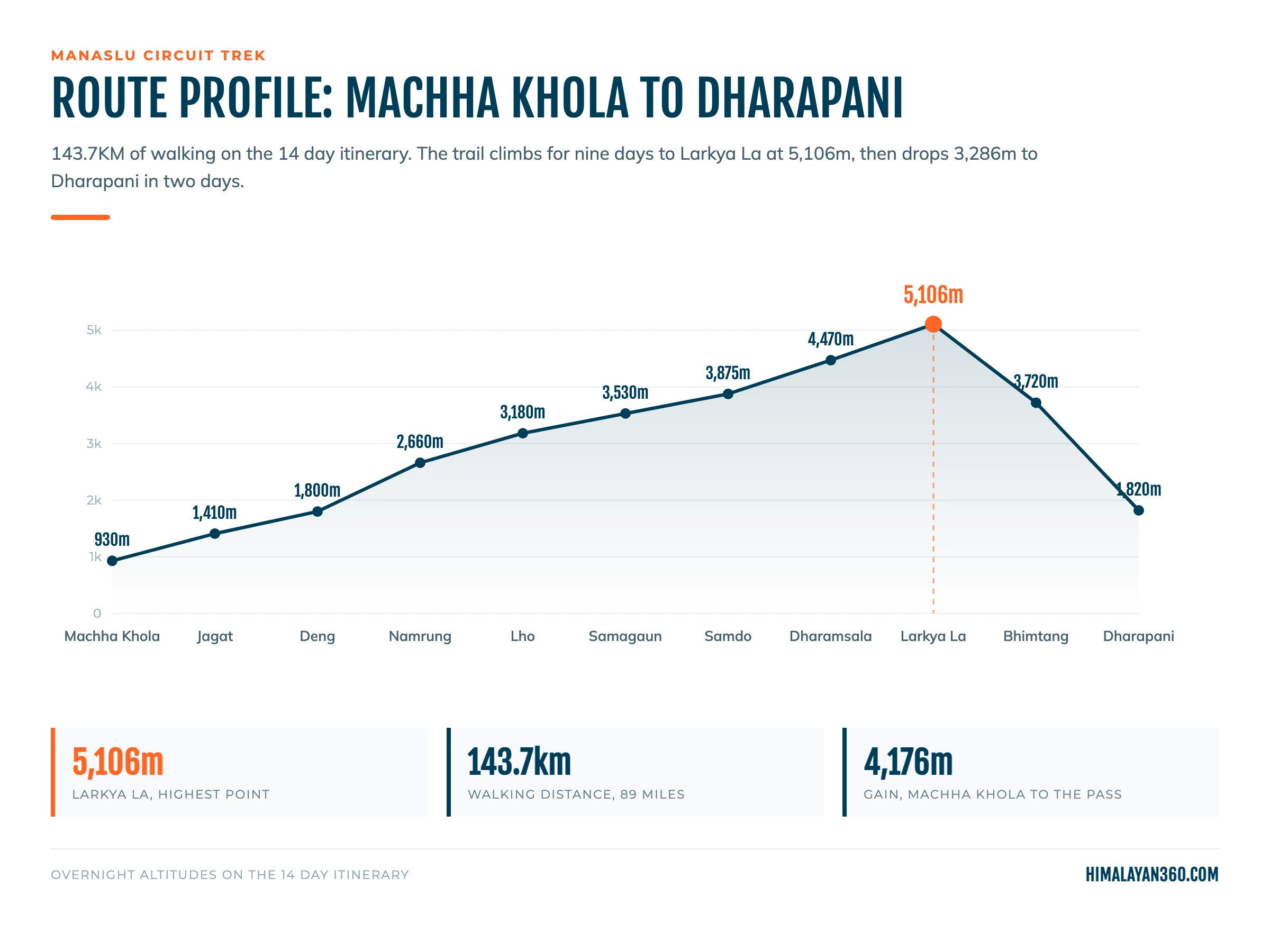
143.7KM (89 miles) on foot, Machha Khola to Dharapani. Adding the road transfers at both ends brings the whole journey from Kathmandu and back to about 514KM, of which about 370KM is driving.
| Segment | Distance |
|---|
| Walking, Machha Khola to Dharapani | 143.7KM (89 miles) |
| Longest walking day, Dharamsala to Bhimtang over Larkya La | 24.8KM, 9 hours |
| Driving, Kathmandu to Machha Khola and Dharapani back | About 370KM |
| Total trip distance | About 514KM |
Published figures for this trek range from 140KM to 177KM depending on where the operator starts counting and whether side trips are included. Ours counts walking only, Machha Khola to Dharapani, without the Manaslu Base Camp detour.
Why Hours Beat Kilometres
A flat 20KM at home and a 20KM day here are not the same thing, which is why itineraries are written in hours. Below Jagat the trail never stays level, so a short day on the map is a long day on the legs, and above Samdo the distances shrink while the times stay the same because at 4,000M a normal pace is no longer available. Plan from the hours column in the itinerary, not the kilometre total.
Getting to the Trailhead
The trailhead is about 150KM northwest of Kathmandu at Machha Khola, which replaced Soti Khola once the road was extended. The drive takes about 9 hours, paved as far as Arughat and rough after that.
- Public bus. USD 15 to 30 per person one way, about 10 hours, leaving Gongabu Bus Park between 6:00 and 7:00 AM.
- Private jeep. USD 180 to 250 per vehicle one way, 7 to 8 hours, hotel pickup. A 4WD carries 6 to 7 people. Ordinary cars cannot pass Arughat.
Manaslu Circuit Trek Itinerary, Day by Day
The standard itinerary runs 14 days: two in Kathmandu, the drive on day 3, ten walking days, and the drive back on day 14.

| Day | Route | Altitude | Walking Hours | Highlights |
|---|
| 01 | Arrival in Kathmandu | 1,400M | | Airport transfer, trek briefing |
| 02 | Kathmandu, preparation and sightseeing | 1,400M | | Pashupatinath, Boudhanath, permits filed |
| 03 | Drive to Machha Khola | 930M | ~9 hours drive | Prithvi Highway, first views of the Budhi Gandaki |
| 04 | Machha Khola to Jagat | 1,410M | 7 to 8 hours | Budhi Gandaki river, Gurung villages, waterfalls. Restricted area begins |
| 05 | Jagat to Deng | 1,800M | 6 hours | Dense forest, entry into the Manaslu Conservation Area |
| 06 | Deng to Namrung | 2,660M | 7 hours | Ghap village, Tibetan culture, Ganesh Himal appears |
| 07 | Namrung to Lho | 3,180M | 6 hours | First proper views of Manaslu, Himalchuli, Ngadi Chuli |
| 08 | Lho to Samagaun | 3,530M | 4 hours | Pungyen glacier views, mani walls |
| 09 | Samagaun, acclimatisation | 3,530M | 3 hours, or 6 to 7 to Base Camp | Manaslu Base Camp or Birendra Lake (3,691M) |
| 10 | Samagaun to Samdo | 3,875M | 4 hours | Short day, Tibetan border views, yak pastures |
| 11 | Samdo to Dharamsala | 4,470M | 4 hours | Last camp before the pass |
| 12 | Dharamsala to Larkya La to Bhimtang | 5,106M | 9 hours | The pass. 24.8KM, the longest day of the trek |
| 13 | Bhimtang to Dharapani | 1,820M | 8 to 9 hours | Rhododendron forest, Marsyangdi valley |
| 14 | Drive to Kathmandu | 1,400M | ~9 hours drive | Return drive |
Operators run this anywhere from 12 to 20 days. The difference is almost entirely acclimatisation nights, not extra ground. We run the same route as a 13 day trek from Kathmandu, which adds a second acclimatisation day at Samdo, and as a 12 day trek for trekkers who have already been high and are short of time.
Manaslu Circuit Trek Map and Route
The route is a horseshoe, not a true circle. You walk north up one valley and come out west into another, which is why the trek needs vehicles at both ends and why there is no way to shorten it by turning back.
Side trips worth the day: Manaslu Base Camp and Birendra Lake from Samagaun, Pungyen Gompa on the glacier, and the old trading route above Samdo toward the Tibetan border.
Larkya La Pass: The Crossing Day
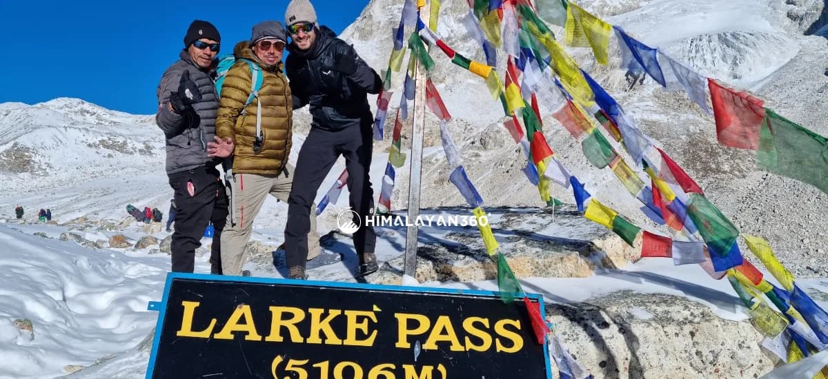
Larkya La, also written Larke Pass or Larkya La Pass, is the high point of the circuit at 5,106M. The crossing from Dharamsala (4,470M) to Bhimtang is the hardest day on the circuit: 24.8KM and 9 hours at the highest elevation you will reach. Groups leave Dharamsala around 5 AM, because the wind on the pass builds through the afternoon and the descent on the far side is long.
The climb passes frozen tarns and glacial moraine, and the last hour to the 5,106M pass is slow purely because of the air. From the top the trail drops steeply through moraine to Bhimtang. The rest day at Samagaun is what makes this day possible rather than punishing.
Three things decide how it goes. A bed at Dharamsala the night before. Leaving on time, because a late start puts you on the pass in the wind. And having slept both acclimatisation nights rather than skipping one to save a day.
Manaslu Circuit Trek Permits in 2026
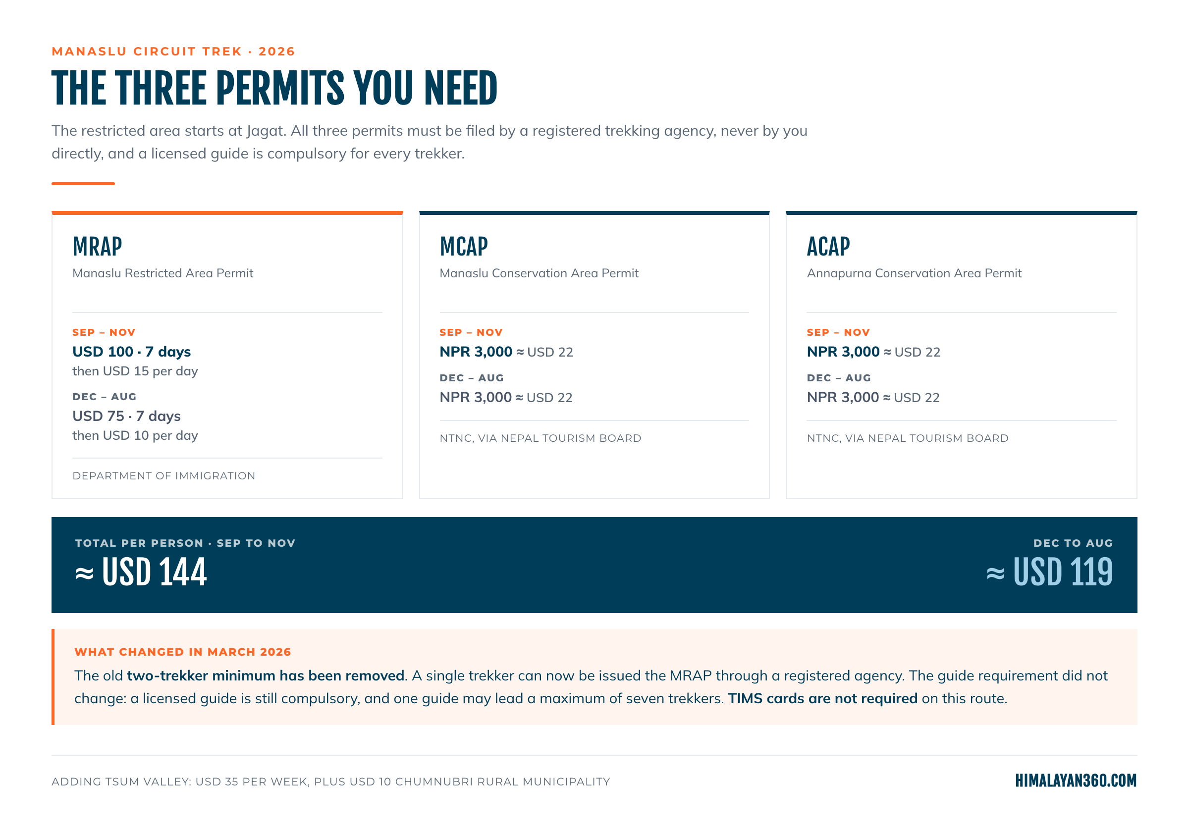
The restricted area begins at Jagat and ends at Dharapani. Three permits cover it, and you cannot obtain any of them yourself.
Why You Cannot Get a Manaslu Permit on Your Own
The Manaslu Restricted Area Permit is never issued to an individual walking into an office. The Department of Immigration only accepts an application filed on your behalf by a government registered trekking agency, and that agency must name the licensed guide walking with you. There is no online portal, no counter to queue at, and no way to buy the permit on arrival at Jagat.
A freelance guide cannot file it either, however good they are: the agency licence is what the Department checks, and the registered company stays on record for your permit, your guide and your insurance. The permit itself cannot be issued until you are in Nepal, because the application needs the visa page in your passport.
We file these for every trekker on our departures. Talk to us before you book flights, because the guide's name goes on the application.
What Each Permit Costs
| Permit | Sep to Nov | Dec to Aug | Issued by |
|---|
| Manaslu Restricted Area Permit (MRAP) | USD 100 for 7 days, then USD 15 per day | USD 75 for 7 days, then USD 10 per day | Department of Immigration |
| Manaslu Conservation Area Permit (MCAP) | NPR 3,000 (about USD 22) | NPR 3,000 (about USD 22) | NTNC, via Nepal Tourism Board |
| Annapurna Conservation Area Permit (ACAP) | NPR 3,000 (about USD 22) | NPR 3,000 (about USD 22) | NTNC, via Nepal Tourism Board |
| Total per person | About USD 144 | About USD 119 | |
The conservation fees are set in rupees and paid in rupees. The permit desks do not take foreign currency, which is worth knowing because dollar figures published elsewhere disagree with each other by a factor of three.
SAARC nationals pay NPR 1,000 each for MCAP and ACAP. Nepali citizens do not need the MRAP.
Adding Tsum Valley costs USD 35 per person for one week, plus USD 10 for the Chumnubri Rural Municipality permit.
ACAP is on the list because of geography. The circuit comes down off Larkya La through Bhimtang and Dharapani, and that side of the pass is inside the Annapurna Conservation Area. You walk out of one conservation area and into another on the same day.
Everything above Jagat sits inside the Manaslu Conservation Area, which is what the MCAP fee pays for. It is a 1,663 square kilometre protected area run by a trust rather than a ministry, and being inside it means three things on the trail: no open fires, all rubbish carried out, and no leaving the marked route without your guide. More on the conservation area and its wildlife.
What Changed in March 2026
The rule that two trekkers were required for a restricted area permit was removed on 22 March 2026. A single trekker can now be issued the MRAP through a registered agency.
What did not change is the guide. Every trekker in the restricted area must be accompanied by a licensed guide, and one guide may lead a maximum of seven trekkers. TIMS cards are not required on this route.
This matters because most of the internet has not caught up. Pages ranking on page one for "manaslu circuit trek permit" still tell readers they need a second person, and so does Google's own AI summary of this trek. If you have been told you cannot walk this trail alone, that advice is out of date.
| Rule | Before March 2026 | Now |
|---|
| Minimum trekkers per restricted area permit | Two | One |
| Licensed guide | Compulsory | Compulsory, unchanged |
| Trekkers per guide | Not capped in practice | Maximum of seven |
| Starting the paperwork | In Kathmandu, in person | Digitally, from abroad |
What You Need to Hand Over
Himalayan 360 will ask for a passport copy, your Nepal visa, two to four passport photographs, and a travel insurance policy covering trekking to at least 6,000M including helicopter evacuation. Permits are normally issued the same working day. The Department does not issue on Saturdays or public holidays, so a Friday arrival for a Saturday start does not work.
Trekking the Manaslu Circuit Solo
You can trek the Manaslu Circuit solo. You cannot trek it unaccompanied. Solo here means a private trek: you are the only paying client, walking with your own guide, on your own permits. Before the March 2026 change you had to find a stranger to pair up with first. You no longer do.
Applying for the Permit From Abroad
The Department of Immigration now lets agencies begin your permit using the Visa Application Submission ID you receive when you apply for your Nepal visa online. So the order is:
- Apply for your Nepal visa online.
- Send the Visa Application Submission ID to your agency with your documents.
- The agency starts the Manaslu permit before you land.
You still have to enter Nepal properly with a valid visa and passport, but you are not spending a jet-lagged day going between offices in Kathmandu.
What Solo Costs
More, not less. The guide wage, the vehicle and the agency's fixed costs stop being split six ways, so our own price is USD 1,430 solo against USD 980 in a group of four to six, a difference of 41 percent. Permits cost the same either way. If it is a quiet trail you want, a shoulder week in late September or early March buys more of it than USD 450 does.
Is It Safe Walking Solo With a Guide?
Yes, and in some ways safer than a busy trail. Most people who get into trouble here do so by moving too fast, not by walking alone, and one experienced person reading the weather and your pace is worth more than a crowd nobody is watching. Your guide's job is not to lead the way, it is to make the call when conditions change, including the call to stop.
One thing solo trekkers have to do deliberately: say how you feel out loud. Nobody else is watching your altitude symptoms.
Solo Female Trekkers
The same route under the same rules, with a guide and an agency behind you. Three things worth asking for when you book: a female guide or porter if the company has one, teahouses they use regularly rather than whichever has space, and a clear plan for the Dharamsala night, where beds are tightest. In practice you are rarely alone on this trek, because the guide is with you the whole way.
How Much Does the Manaslu Circuit Trek Cost?
A guided package runs USD 920 to 1,430 per person depending on group size. What you actually spend, counting permits, insurance, a porter, tips and the visa, is about USD 1,550 in a group of four to six and USD 2,180 solo.
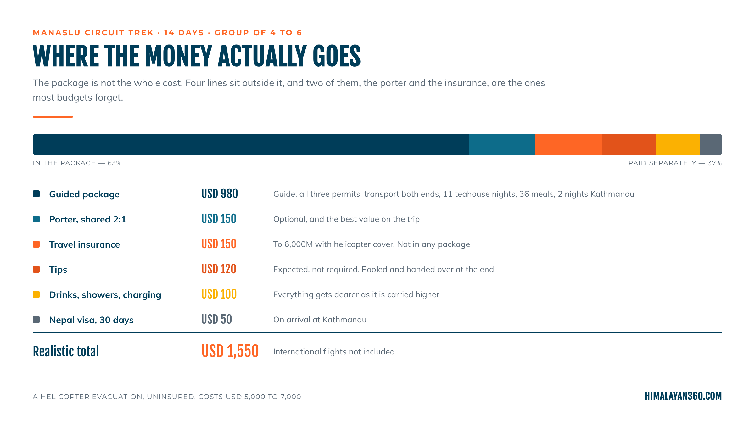
The two lines most budgets miss are the porter, which no package here includes, and travel insurance, which is compulsory and excluded. Neither is optional when a helicopter evacuation from this valley costs USD 5,000 to 7,000. Every line is broken down in the Manaslu Circuit Trek cost guide.
Best Season to Trek the Manaslu Circuit
Autumn, from late September to November, is the best time, with spring, from March to May, second. Both give stable weather and a Larkya La crossing that is passable without winter equipment.
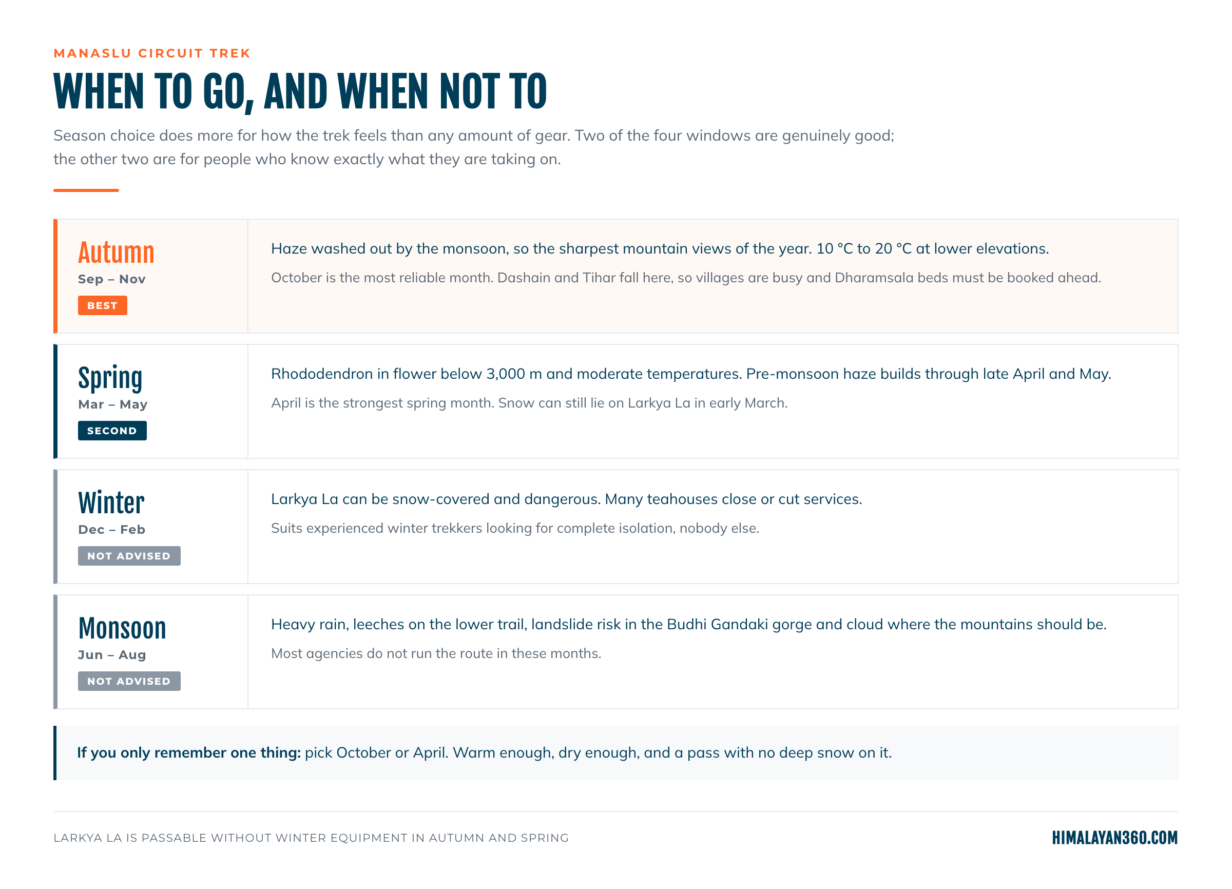
Autumn, September to November
The monsoon has washed the haze out, so the mountain views are the sharpest of the year, and daytime temperatures lower down run 10°C to 20°C. October is the most reliable month on this route. Dashain and Tihar fall in this window, so the villages are busy with festivals.
Spring, March to May
Rhododendron in flower below 3,000M and moderate temperatures. Visibility is good but not as sharp as autumn, because pre monsoon haze builds through late April and May. Snow can still lie on Larkya La in early March. April is the strongest spring month.
Winter and Monsoon
Winter, December to February, is cold and quiet. Larkya La can be snow covered and dangerous and many teahouses close. It suits experienced winter trekkers and nobody else.
Monsoon, June to August, brings heavy rain, leeches on the lower trail, landslide risk in the Budhi Gandaki gorge and cloud where the mountains should be. Most agencies do not run the route in these months.
How Busy Is the Manaslu Circuit?
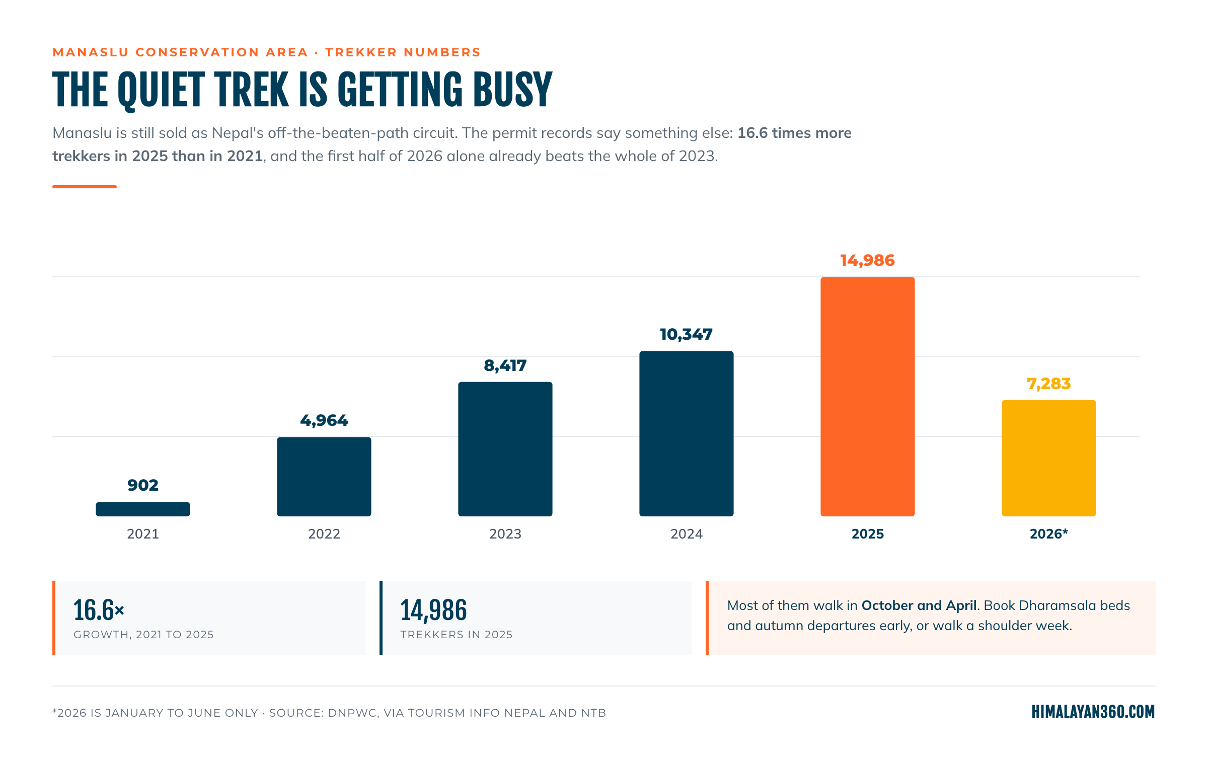
Almost every page written about this trek, including ours until recently, calls it off the beaten path. The permit records no longer support that.
| Year | Trekkers in the Manaslu Conservation Area |
|---|
| 2021 | 902 |
| 2022 | 4,964 |
| 2023 | 8,417 |
| 2024 | 10,347 |
| 2025 | 14,986 |
| 2026, January to June | 7,283 |
16.6 times more trekkers in 2025 than in 2021, and the first half of 2026 alone is close to the whole of 2023.
That is not a reason to go elsewhere. Fifteen thousand people spread across a 14 day route is still a fraction of the Annapurna Circuit, and the upper valley is genuinely remote. It means two specific things:
- October and April are crowded now. The bottleneck is not the trail, it is beds. In peak weeks a departure that has not reserved ahead is gambling.
- The shoulder weeks are the value. Late September, early December and early March are quieter, and on this route quiet is most of what you came for.
Figures are Department of National Parks and Wildlife Conservation records, published via Tourism Info Nepal and the Nepal Tourism Board. For 2025 and 2026 the source's foreign and SAARC sub totals do not sum to its stated totals, so the totals are reproduced as published.
Weather and Temperature on the Trail
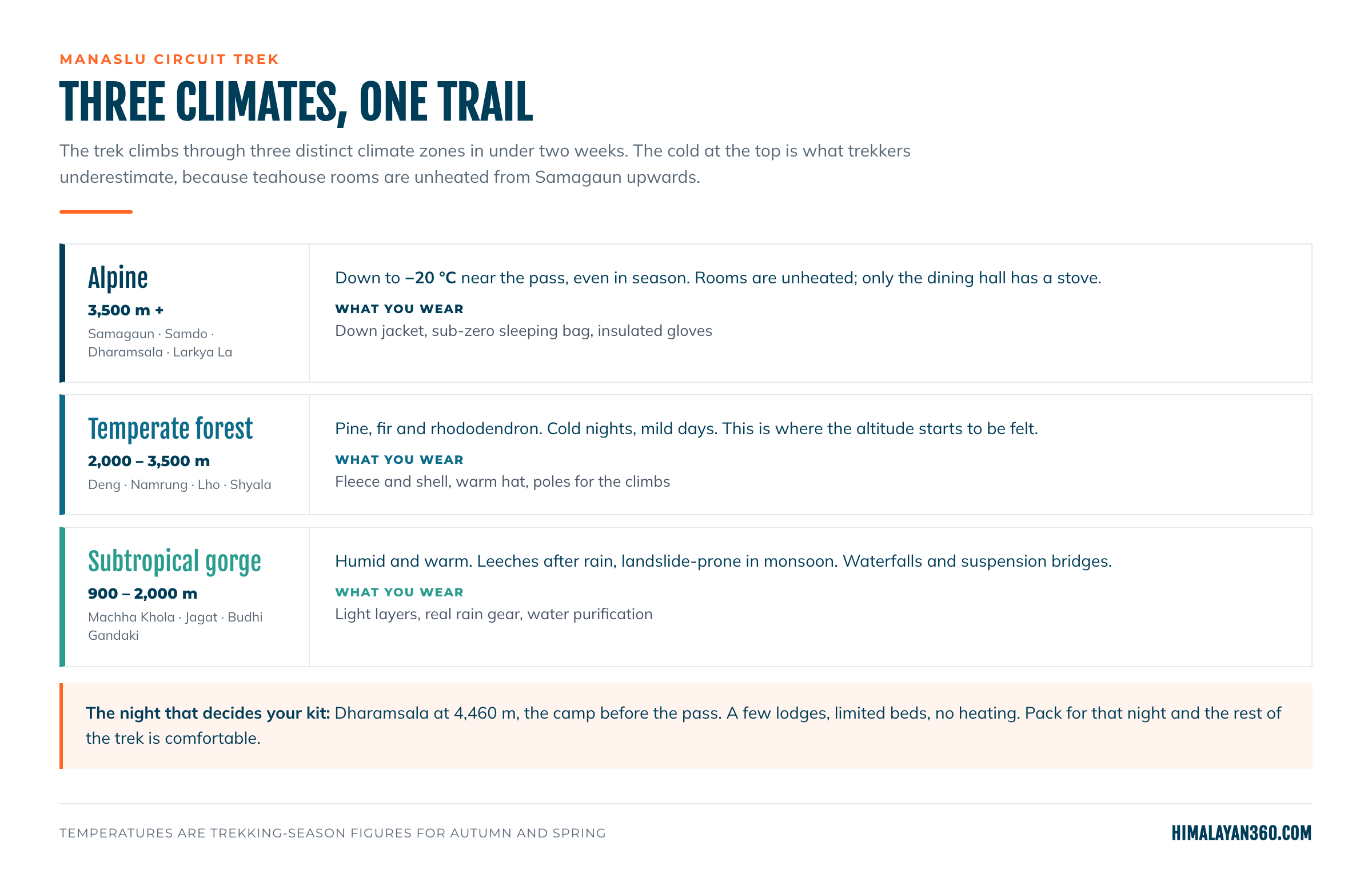
The trek passes through three climates in under two weeks, which is why one packing list has to cover leeches and frostbite.
- Subtropical, 900M to 2,000M. The Budhi Gandaki gorge from Machha Khola to Jagat. Humid and warm, leeches after rain, landslide prone in monsoon.
- Temperate forest, 2,000M to 3,500M. Deng to Shyala. Pine, fir and rhododendron, cold nights and mild days. This is where the altitude starts to be felt.
- Alpine, above 3,500M. Samagaun to the pass. Near Larkya La it reaches -20°C even in trekking season.
The cold at the top is what trekkers underestimate. Dharamsala at 4,470M is the night that decides your kit. Pack for that one night and every night below it is comfortable, which is what the packing list is built around.
Altitude Sickness and Acclimatisation
Altitude sickness happens when the body cannot adjust fast enough to lower oxygen. The common form is Acute Mountain Sickness, which feels like a strong hangover: headache, nausea, dizziness, tiredness. HAPE and HACE are rarer and dangerous. HAPE affects the lungs and causes breathlessness at rest; HACE affects the brain and shows as confusion, poor balance and behaviour that is out of character.
The difficulty on this route is not the pass, it is the five days before it. Sleeping altitude climbs 2,660M at Namrung, 3,180M at Lho, 3,530M at Samagaun, 3,875M at Samdo, 4,470M at Dharamsala: 1,810M in five days, which stays inside the safe rule only because of the rest day.
The measures are the same every day. Gain no more than 300 to 500M of sleeping altitude per day above 3,000M. Drink 3 to 4 litres of water. Eat properly, even when the appetite goes, which it does above Samagaun. Take the rest day at Samagaun and the night at Samdo seriously, because they are what carry you over Larkya La. The optional walk to Manaslu Base Camp (4,800M) or Birendra Lake (3,691M) on the Samagaun day is a climb high, sleep low exercise rather than sightseeing. Some trekkers take preventive medication on medical advice, but pace and honesty about symptoms do more than any tablet.
Descending is the treatment. Nothing else reliably works, and on this route descending is slow, which is the argument for not pushing a bad day.
Teahouses, Food and Cold
Teahouses serve Nepali, Tibetan and simple Western food. Dal bhat (rice, lentil soup, vegetable curry and pickles, with free refills) is the staple, alongside thukpa, momos, Tibetan bread, pasta, fried rice and pancakes.
Rooms are basic: twin beds, thin mattresses, shared bathrooms, no heating. The dining hall with its stove is the only warm room in the building, which is why evenings are spent there. Dharamsala has only a few lodges with limited beds, so in October and April a guide who has called ahead is the difference between a bed and the dining hall floor before the hardest day of the trek.
What Is Available Where
Plan on paying, and plan on going without above Samdo. Carry rupees from Kathmandu, because there is no ATM after Arughat and every tea, shower and charge on the trail is cash.
| Village | Altitude | Hot shower | Wi-Fi | Charging |
|---|
| Machha Khola | 930M | Yes | Yes | Yes |
| Jagat | 1,410M | Yes | Yes | Yes |
| Deng | 1,800M | Yes | Limited | Yes |
| Namrung | 2,660M | Yes | Yes | Yes |
| Lho and Shyala | 3,180M to 3,530M | Limited | Limited | Yes |
| Samagaun | 3,530M | Yes | Limited | Yes |
| Samdo | 3,875M | Limited | No | Limited |
| Dharamsala | 4,470M | No | No | Limited |
| Bhimtang | 3,590M | Limited | No | Limited |
What to Pack for the Manaslu Circuit
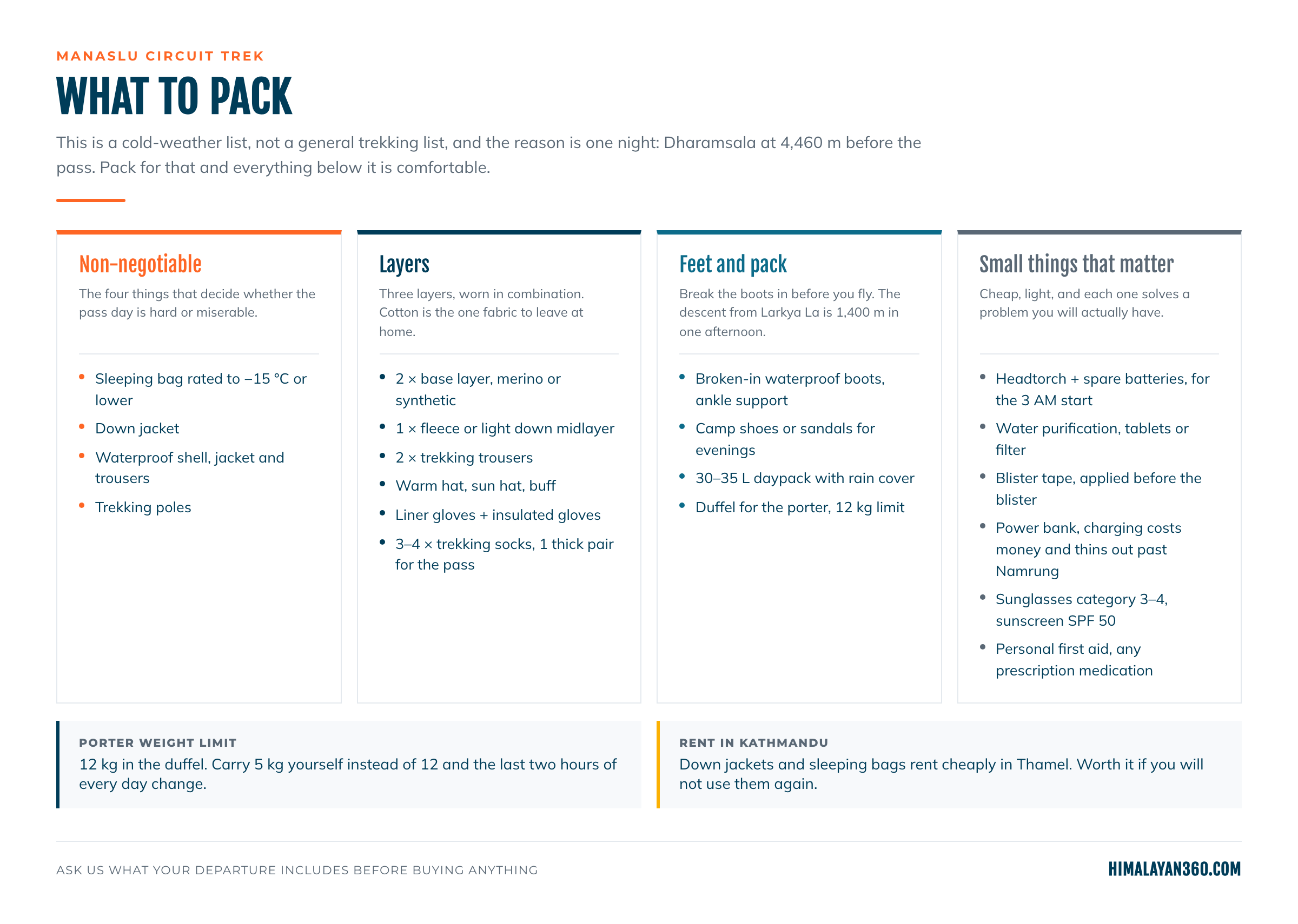
This is a cold weather list rather than a general trekking list, and the reason is Dharamsala.
The four that decide the pass day
- Sleeping bag rated to -15°C or lower. Rooms are unheated from Samagaun upwards. The single item people most often get wrong.
- Down jacket, for evenings and the 5 AM start.
- Waterproof shell, jacket and trousers. Genuinely waterproof, not shower resistant.
- Trekking poles. The drop from Larkya La to Bhimtang is 1,400M in one afternoon and it is where knees fail.
Cotton is the one fabric to leave at home, and the porter weight limit is 12KG. Carrying 5KG instead of 12KG changes the last two hours of every day, which is the cheapest comfort on the trip. Everything else is in the checklist below.
Packing Checklist
The four in the first column are the ones that decide whether the pass day is hard or miserable. Everything else is comfort or contingency.
 Trek
Trek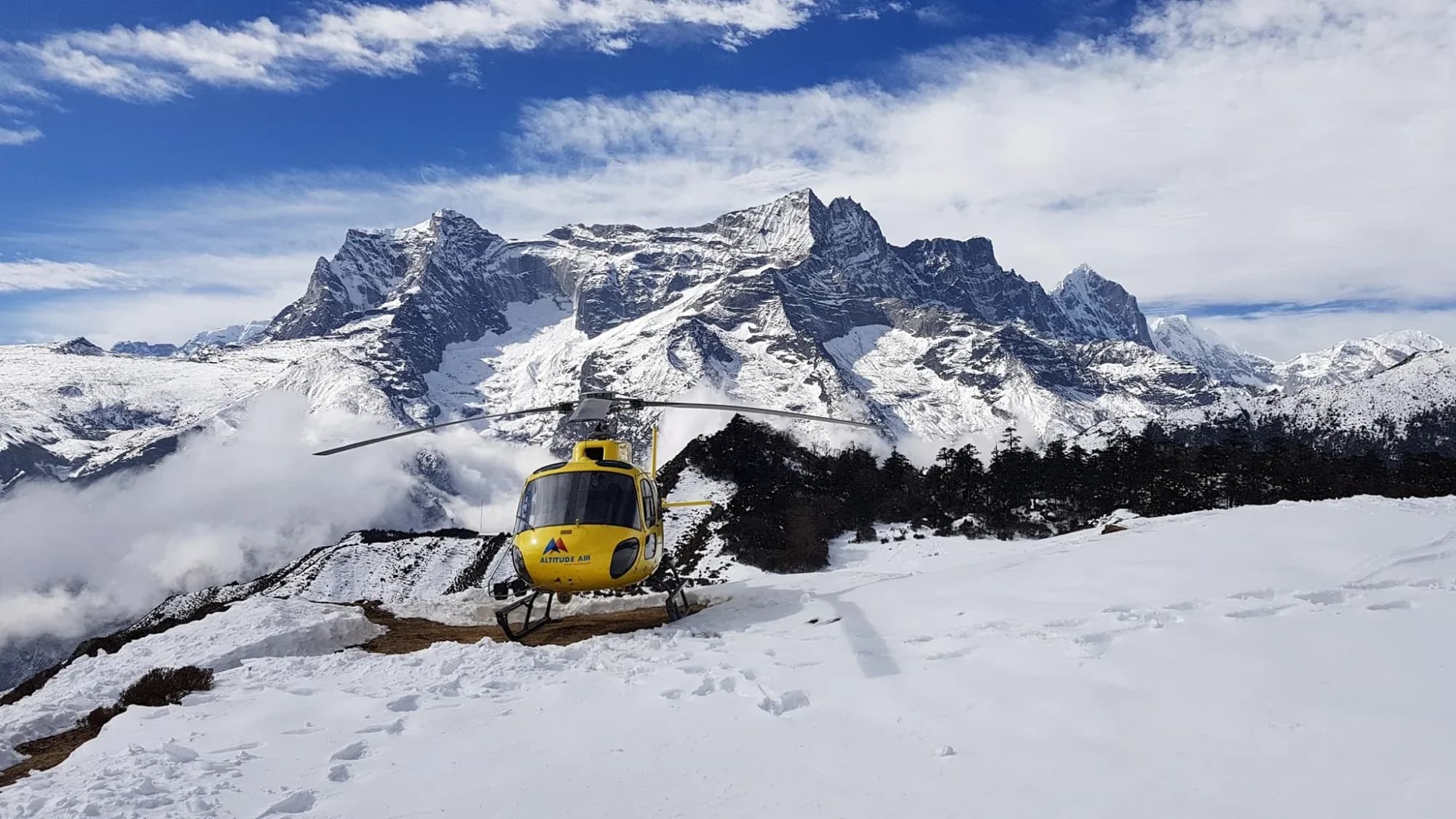 By air
 Pilgrimage
 Festivals
 Wildlife
 Luxury
 Yoga
Yoga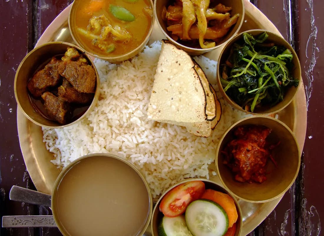 Food
Food Heritage