Langtang Valley Trek at a Glance
| Walking distance | 84.9KM on our itinerary, 65 to 75KM counting only the valley |
| Duration | 8 days from Kathmandu, 6 of them walked |
| Highest sleeping point | Kyanjin Gompa, 3,870M |
| Highest point reached | Tserko Ri, near 4,984M, on a day hike |
| Start and finish | Syabrubesi (1,460M), out and back |
| Difficulty | Moderate, non technical, no pass |
| Hardest day | Syabrubesi to Lama Hotel, about 1,000M of climb |
| Best months | October, then April |
| Permits | Park entry and TIMS. NPR 5,000, about USD 37 |
| Guide | Compulsory. National rule since March 2023, enforced here since February 2025 |
| Package price | From USD 449 per person |
| Accommodation | Teahouses throughout, unheated rooms |
| Access in 2026 | Road to Syabrubesi destroyed and no reopening date. Walk in from Sundarijal |
Can You Trek Langtang Right Now?
Yes, and only on foot.
The trail from Lama Hotel through Langtang village to Kyanjin Gompa is walkable and its teahouses are standing. The Trekking Agencies' Association of Nepal, in its 4 September 2026 notice, lists the Langtang and Kyanjin valley and Gosaikunda as safe, and states that the road from Battar through Dhunche to Syabrubesi remains closed. So there is one approach, not two.
TAAN's recommended alternative is the walk in from Sundarijal: Helambu, Thadepati, Ghopte, Gosaikunda, Thulo Syabru, Lama Hotel, Langtang, Kyanjin, never touching the destroyed road. It is longer and harder than the trip you were sold, and it puts Lauribina La in the first half rather than at the end. Dhunche is not a shortcut around it: you will read that it is reachable, and as of that notice the road to it is closed too.
The Department of Roads is prioritising the 10KM Bidur to Betrawati section, still stalled in early September by a compensation protest and a land dispute. Its own director general said on 6 September that the Dhunche, Syabrubesi and Rasuwagadhi road will be difficult to rebuild soon, because there is practically no trace of it left. Nobody has announced a reopening date, and the person in charge of the road has said the opposite.
What happened to Syabrubesi is the difference between a road repair and a rebuild. The European Union's Copernicus service mapped the town from satellite imagery taken the day after the flood: 559 buildings surveyed and 433 classified as affected, six bridges, a helipad and about 9.5KM of primary road destroyed across Syabrubesi and Timure. That assessment was not field-validated, so read it as an order of magnitude.
Treat a rebooked Langtang as a new itinerary, not the old one with a longer transfer, and an operator quoting the standard eight day drive-in for October has not checked. Every trek's dated status is on our post-flood route board, and we will confirm the corridor for your dates before you book flights.
Which Langtang Trek Should You Book?
Four itineraries are sold here and they are not variations of one trek.
| Trek | Days | From | Highest point | Book it if |
|---|
| Langtang Valley Trek | 8 | USD 449 | Kyanjin Gompa 3,870M, ridges above | You want glaciers and a Himalayan valley in one working fortnight |
| Gosaikunda Short Trek | 5 | USD 200 | Gosaikunda 4,380M | You want one sacred lake and you have five days |
| Langtang Gosaikunda Trek | 13 | USD 659 | Lauribina La 4,610M | You want the valley and the lakes, and you have the fortnight |
| Tamang Heritage Trek | 6 | USD 360 | Nagthali 3,165M | You want villages rather than altitude. Closed in 2026 |
Read that table for a normal year, then apply the flood to it. The Tamang Heritage Trek is the outright casualty: it is the villages immediately around Syabrubesi, so it does not survive the loss of the town. It is closed this season, and anyone selling it is selling you a town that is not there. The Gosaikunda Short Trek drives to Dhunche, and that road is closed too, so ask us what the approach looks like before assuming the five day version is still five days. Between the other three it comes down to glaciers against lakes, which is the Gosaikunda question.
How Hard Is the Langtang Valley Trek?
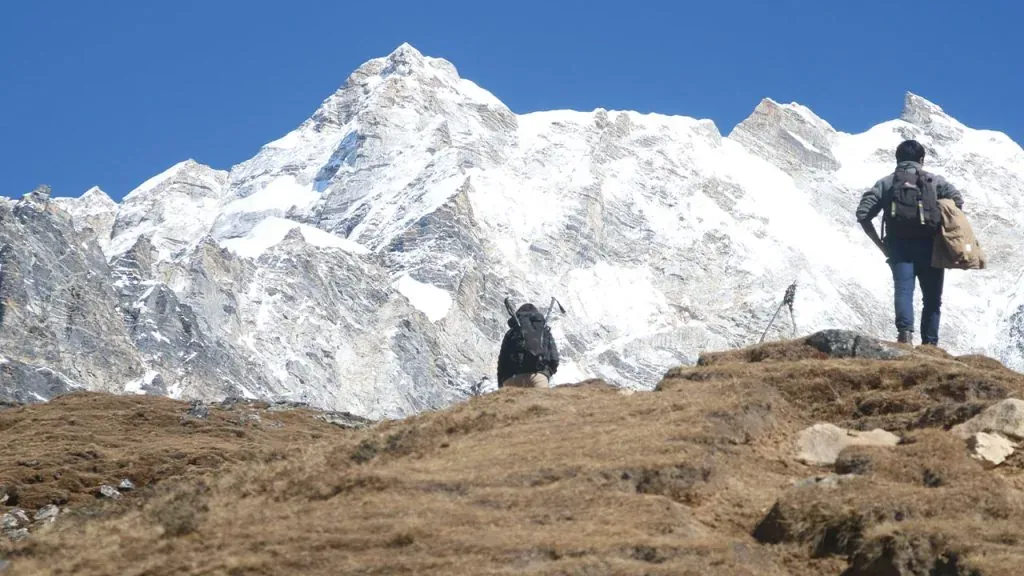
Moderate, and non technical. No ropes, no pass, no night above 3,870M. Four things make it harder than that sounds, and none is altitude.
- The climb to Lama Hotel. Day one on foot gains roughly 1,000M from Syabrubesi, on the steepest sustained ground of the route.
- The trail surface. Stone, root and loose rock rather than a graded path, which is why itineraries here are written in hours.
- The descent. You come down the same valley you climbed, and the drop from Kyanjin Gompa to Lama Hotel is where knees fail. Poles are not optional.
- The ridge day. Tserko Ri adds 1,100M of climbing to what the itinerary calls a rest day.
The real risk is none of those. It is compressing the trek: the day people cut is the acclimatisation day at Kyanjin Gompa, and the arithmetic does not survive it.
Can a Beginner Do the Langtang Valley Trek?
Yes, and this is the trek we recommend most often to people who have never walked at altitude. Someone who can manage six hours on hills, two days running, with a daypack, will finish.
What stops them is rarely thin air. It is footwear on the climb to Lama Hotel, and it is pace: the valley is forgiving enough that a fit beginner moves faster than they should on day two, arrives at Langtang Village with a headache, and loses the ridge day to it. If it is your first Himalayan trek, spend the extra day rather than the extra money on gear.
Train for four to six weeks around time on your feet: hill walks of 4 to 6 hours, two days back to back, with the daypack you will use, plus step downs and lunges for the descent back to Syabrubesi.
Is Langtang Easier Than Everest Base Camp?
Yes, clearly, and the gap is bigger than the marketing on either trek suggests.
| Langtang Valley | Everest Base Camp |
|---|
| Highest point reached | Around 4,984M, on an optional day hike | 5,545M, Kala Patthar |
| Highest sleeping altitude | 3,870M, Kyanjin Gompa | Above 5,000M at Gorak Shep |
| Trip length | 8 days, 6 walked | 14 days |
| Getting there | Road from Kathmandu | Flight to Lukla |
| Passes crossed | None | None on the standard route |
| Package price with us | From USD 449 | From USD 1,260, plus flights |
| What can cancel your trip | The road | The weather at Lukla |
The one place Langtang is harder is the daily climb rate: Syabrubesi to Lama Hotel gains roughly 1,000M in a day, steeper than the graded Everest itinerary ever asks.
Every other row favours Langtang for a first trek. If you want altitude, go to Everest. For a Himalayan valley inside two weeks, come here, or weigh it against Langtang Valley Trek vs Annapurna Base Camp.
Langtang Valley Trek Itinerary, Day by Day
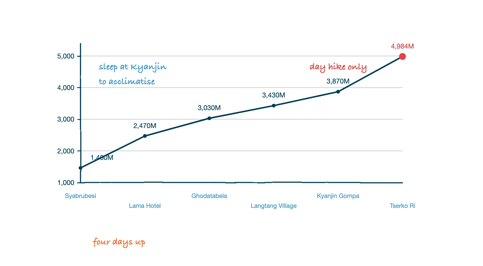
Our standard eight day itinerary: two drive days at the ends, six walking days between them. Plan from the hours column rather than the kilometres, because below Ghodatabela the trail never stays level.
| Day | Route | Altitude | Hours | Notes |
|---|
| 01 | Kathmandu to Syabrubesi | 1,460M | 6 hours drive | Pasang Lhamu Highway, park checkpoint at Dhunche |
| 02 | Syabrubesi to Lama Hotel | 2,470M | 6 hours | The biggest climb of the trek. Bamboo and oak forest |
| 03 | Lama Hotel to Langtang Village | 3,430M | 6 to 7 hours | Forest thins above Ghodatabela. The 2015 debris field |
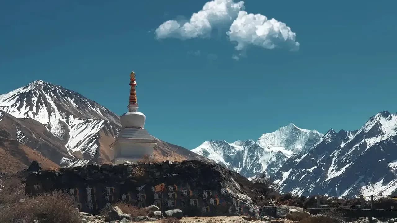
| 04 | Langtang Village to Kyanjin Gompa | 3,870M | 3 to 4 hours | Short by design. Yak pasture, mani walls, moraine |
| 05 | Kyanjin Gompa, acclimatisation | About 4,600M or 4,984M | 2 to 8 hours | Kyanjin Ri or Tserko Ri. The day people came for |
| 06 | Kyanjin Gompa to Lama Hotel | 2,470M | 7 hours | Long descent, hard on the knees |
| 07 | Lama Hotel to Syabrubesi | 1,460M | 5 hours | Riverside trail back through the forest |
| 08 | Syabrubesi to Kathmandu | 1,400M | 6 hours drive | Return drive |
Days one and eight are the rows the 2026 flood changed. Read them as placeholders, and read the route status as the real plan for this season.
Ask about Sherpagaon when you book. Your first night, Lama Hotel (2,470M), is a row of lodges in the trees with no view. Sherpagaon (around 2,600M) on the upper route above the gorge is the alternative most pages never mention: open hillside, few beds, no crowd, and it only works if someone has called ahead.
How Many Days Should It Be?
Eight. You will find it sold at anything from three to ten, and eight is the only length that keeps both the short fourth day, which caps the sleeping altitude gain at 440M, and the rest day above it. Fold days four and five together and you have removed the acclimatisation from your acclimatisation day. If four or five days is all you have, book the Gosaikunda Short Trek instead.
Kyanjin Ri or Tserko Ri?
This is the decision the trek is built towards, and the answer is not the higher one by default.
Kyanjin Ri rises straight behind the village: two to four hours return, level with the Lirung glacier close enough to hear it crack, and back for lunch. It has two tops, a lower viewpoint around 4,300M where most people stop and a higher one around 4,600M. Tserko Ri is the long eastern ridge, six to eight hours return and around 1,100M of climbing, and it gives the view people photograph: the whole valley end to end, and on a clear day Shishapangma across the Tibetan border.
Choose on three things.
- How you slept. If you woke with a headache, Kyanjin Ri is the acclimatisation walk and Tserko Ri is a bad idea. Climbing 1,100M on a bad night is how a manageable trek turns into a descent.
- The weather. Langtang Lirung makes its own cloud and can close in by ten while the valley floor stays in sun. If your clear morning is not the one the itinerary assigns to the ridge, go anyway: your guide can move it.
- How many mornings you have. Two nights at Kyanjin Gompa buys both: Kyanjin Ri the afternoon you arrive, Tserko Ri the next morning.
The heights you will read for these ridges are mostly wrong, including ours until this month. Tserko Ri is 4,984M or 4,985M, which mapping data and the geological literature on the Tsergo Ri landslide agree on; a page that puts it over 5,000M is repeating a trekking company. Kyanjin Ri's upper summit is around 4,600M, not 4,773M. The higher figures appear only on operator sites, ours included.
Nothing about the walk changes. What changes is whether you can say you stood above 5,000M, and you cannot.
Is Gosaikunda Worth Adding?
Gosaikunda (4,380M) is not one lake, and it is sacred to Hindus and Buddhists at once, which very few places in the Himalaya are. It was listed as a Ramsar site on 23 September 2007. You will read everywhere that there are 108 lakes: that is the traditional religious count, and the Ramsar listing describes at least 15 lakes and ponds between about 4,050M and 4,620M.
- Add it if you want the second landscape. The Langtang valley is forest, moraine and glacier. Gosaikunda is a bare alpine basin, and it drops south into Helambu rather than retracing the valley. That is why it is 13 days rather than nine.
- Do not add it if you mainly want the lake. The five day Dhunche route reaches the same water, from USD 200. Eight extra walking days do not make the lake bigger.
- Check your altitude history first. Lauribina La at 4,610M sits 740M above the highest bed on the valley trek, and mapping data puts the saddle nearer 4,650M. Either way it is a pass to get over, not a day hike you can turn back from.
Once a year in August, at Janai Purnima, thousands of Hindu pilgrims and Jhankri shamans climb here for the holy dip while Buddhist monks gather at the same water. Go for the festival, not for the mountains: it falls in the middle of the monsoon. Book beds months out and confirm the date with us, because it moves with the lunar calendar.
The traditions are set out in why Gosaikunda Lake is sacred. Ignore one line you will read everywhere, ours included until now: Guru Rinpoche did not meditate here 600 years ago, because Padmasambhava is an eighth century figure.
Langtang Trek Permits in 2026
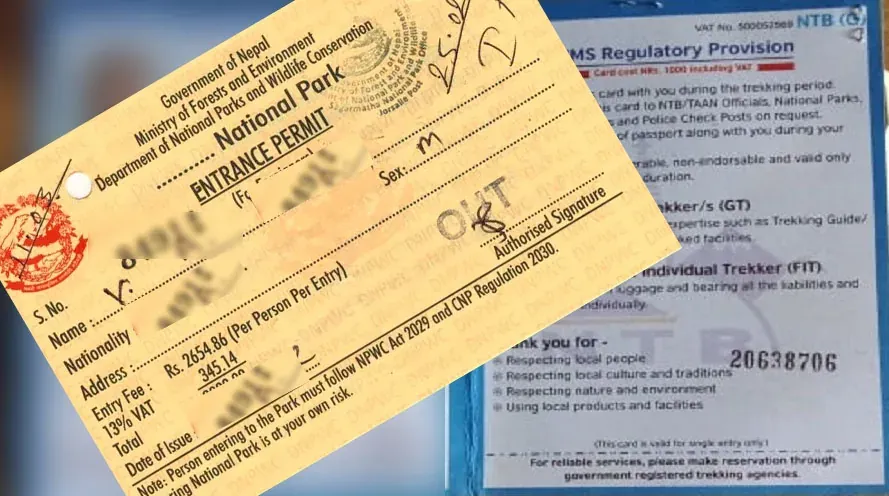
Two permits, NPR 5,000 for a foreign trekker, and neither one is issued to you directly.
| Permit | Foreign | SAARC | Issued by |
|---|
| Langtang National Park entry permit | NPR 3,000 | NPR 1,500 | Nepal Tourism Board, or the Dhunche checkpoint |
| TIMS card | NPR 2,000 | NPR 1,000 | Registered trekking agency, online |
| Shivapuri Nagarjun entry permit, Helambu start or finish only | NPR 1,000 | NPR 600 | Park gate at Budhanilkantha |
| Standard Langtang total | NPR 5,000, about USD 37 | NPR 2,500 | Filed by your agency |
Nepali citizens pay NPR 100 at each park gate, and the SAARC TIMS rate applies to them. Fees include VAT and are set in rupees and paid in rupees. One park pass covers one entry however long your trek, so combining the Langtang valley, the Tamang Heritage trail and Gosaikunda does not double the fee. The only thing that adds a permit is touching Shivapuri Nagarjun, which the Helambu finish does.
What you hand over: a passport copy, your Nepal visa, two photographs and your itinerary. Both permits are usually issued the same working day and run for one month, so getting them weeks early wastes part of it.
The Numbers Most Pages Still Have Wrong
Three figures published all over the internet are out of date, and two were on this site until this month.
| What you will read | What it is now |
|---|
| TIMS card NPR 1,000, blue for groups and pink for SAARC | NPR 2,000 for non-SAARC and NPR 1,000 for SAARC. The coloured paper cards are gone. It is an eCard with a QR code, bought online by your agency |
| Total permits about NPR 4,000, roughly USD 30 | NPR 5,000, about USD 37 |
| Shivapuri Nagarjun entry NPR 500 | NPR 1,000 for foreign nationals, NPR 600 SAARC |
Those are the Nepal Tourism Board's own figures, checked on 9 September 2026. Google's AI summary still gives the TIMS card as NPR 1,000, then a total of about NPR 5,000, which is NPR 1,000 more than its own components add up to. Our Langtang permit guide carries the longer version.
Can You Trek Langtang Without a Guide?
No. The question refuses to die because two things happened three years apart, and most pages describe only one of them.
- 1 April 2023. The Nepal Tourism Board's revised TIMS provision, dated 31 March, named the routes that require a licensed guide and an agency-issued TIMS card: the Langtang trek, the Langtang Gosaikunda trek, both Tamang Heritage routes, Ganja La, Tilman Pass, Helambu and Gosaikunda. Langtang was on the original list, so pages claiming it was exempt in 2023, including one of ours, are wrong.
- February 2025. The Langtang National Park office wrote to TAAN making a guide compulsory for everyone entering this park, Nepali and foreign. That is enforcement catching up with the national rule, not a new rule. Operator pages date the letter to the 15th or the 17th; the Nepali press reported it on 18 February 2025.
Neither permit can be bought by an individual, and the papers are checked at Dhunche before you have taken a step on the trail. Independent trekkers have reported walking past checks. True, and a bad plan, and not because of the fine: the permit is what puts your name and route in a database, and the value of that is realised on the day something goes wrong.
One correction, because it gets confused constantly. The two-trekker minimum Nepal removed on 22 March 2026 applied to restricted area permits: Upper Mustang, Manaslu, Dolpo. Langtang is not a restricted area, so none of it applies here.
How Much Does the Langtang Valley Trek Cost?
A guided package with us runs USD 449 to 530 per person depending on group size, the cheapest Himalayan trek we sell and the cheapest that puts you under a 7,000M peak.
| Group size | Price per person |
|---|
| 2 people | USD 530 |
| 3 people | USD 499 |
| 4 to 6 | USD 490 |
| 7 to 12 | USD 470 |
| 13 to 20 | USD 449 |
That covers transfers, seven nights in teahouses, all meals on trek, the guide and the permits. What it does not cover is where most budgets go wrong.
| Line | Typical | Why it is not in the package |
|---|
| Porter, shared 2:1 | USD 140 to 210 | Optional, and we would rather price it honestly than hide it |
| Travel insurance | Varies | Compulsory, and it must cover helicopter evacuation |
| Nepal visa | USD 30 for 15 days | Paid on arrival |
| Tips | USD 40 to 100 | Expected, not fixed |
| Hot showers, Wi-Fi, charging | NPR 150 to 500 each | Charged at the lodge, in cash |
| Snacks and drinks on trail | NPR 100 to 600 an item | Yours |
A trekker in a group of four to six spends around USD 800 all in. The two lines people forget are the porter and the insurance, and neither is optional when a helicopter out of here costs thousands. Carry rupees from Kathmandu, because there is no reliable ATM past Dhunche.
Best Season to Trek Langtang
October, then April. Both give stable weather and open teahouses. The rest of the year is a trade.
| Season | Months | Day temperature, lower valley | What you are trading |
|---|
| Autumn | Sept to Nov | 8°C to 18°C | The clearest air of the year, and the most people. September is unreliable |
| Spring | Mar to May | 10°C to 20°C | Rhododendron below 3,000M, hazier views, snow on the ridges in early March |
| Winter | Dec to Feb | -5°C to 10°C | Empty trails and sharp visibility, for cold nights and some closed lodges |
| Monsoon | Jun to Aug | 15°C to 25°C | Green valley and no crowds, for cloud, leeches and a road that closes |
October rather than September. The monsoon now regularly runs into early October, which has quietly made September the weakest of the three autumn months rather than the earliest good one. From mid October the valley gets clear skies for days at a time, and that matters more here than on most treks because the payoff is a ridge view.
Spring buys the rhododendron between Lama Hotel and Langtang Village. Winter buys the valley to yourself, if you will sleep cold above 3,500M. Monsoon is worth it only for Janai Purnima. Month by month figures are in our guide to weather in Langtang.
How Busy Is Langtang Really?
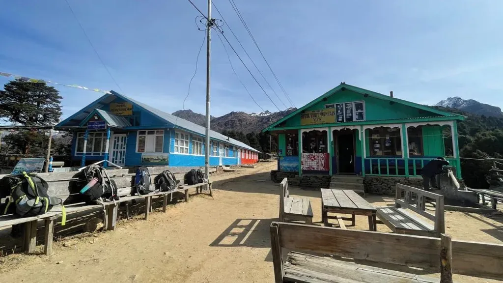
Every page about this trek, including ours, says Langtang is quieter than Everest and Annapurna. True, and the way it is true is more interesting than the claim.
| Langtang National Park visitors, 2025 to 2026 fiscal year | Number |
|---|
| Nepali | 39,011 |
| Foreign nationals | 10,561 |
| SAARC nationals | 788 |
| Total | 50,360 |
Nearly four in five visitors were Nepali. The records do not split them by trail, but from what our guides see that share sits overwhelmingly on the Gosaikunda side, on short trips and around the festival, rather than up the Langtang valley. Two things follow.
- The valley trail is genuinely quiet by Himalayan standards. Ten thousand foreigners across two short seasons is a fraction of what walks the Annapurna or Khumbu trails, which is why beds are usually findable even in October.
- Gosaikunda is not quiet, it is differently busy. That crowd is domestic and peaks on days that have nothing to do with the foreign trekking calendar, so a supposedly deserted alpine lake on a Nepali public holiday is a mismatch on the brochure, not on you.
Numbers fell year on year too, 50,360 against nearly 56,000, and that was before the August 2026 flood. If you are able to come, the money reaches a valley that needs it.
Figures published by Tourism Info Nepal on 6 July 2026 from Langtang National Park office records.
Weather and Temperature on the Trail
The trek climbs more than 2,400M to the highest teahouse and more than 3,500M to the top of Tserko Ri, which is why one packing list has to cover leeches and frostbite. Every 1,000M of ascent takes roughly 6 to 7°C off the temperature: an 18°C afternoon at Syabrubesi is nearer 10°C at Kyanjin Gompa, and below freezing after dark.
- Subtropical to temperate, 1,460M to 2,470M. Warm, humid, and leeches in the forest from June to September.
- Temperate to sub-alpine, 2,470M to 3,430M. Rhododendron in spring, cold nights, cloud building through the afternoon.
- Alpine, 3,430M to 3,870M. Dry, windy, below freezing at night from late autumn, snow possible from late November to March.
- High alpine, above 4,300M. The two ridges, ten to fifteen degrees colder than the village below them.
A forecast for "Langtang" is usually a forecast for Dhunche. The stations sit in the lower valleys and the model grid is coarser than this valley is wide, so read the pattern rather than the day, then subtract the lapse rate.
Walk early. Langtang Lirung makes its own cloud: the peaks are reliably clear in the morning and unreliably clear after about eleven.
Altitude Sickness on a Low Trek
Altitude sickness is the risk people discount here because this is the low trek. The highest bed is 3,870M, which sounds safe. The speed you reach it is not.
You sleep at 1,460M on night one and 3,870M on night four: 2,410M of sleeping altitude in three nights, against a guideline above 3,000M of 300 to 500M a day. Langtang stays inside it only because the fourth day is deliberately short and the fifth is a rest day. Cut either and the itinerary stops obeying its own arithmetic, which is what a five day Langtang trek does.
Acute Mountain Sickness feels like a heavy hangover: headache, nausea, poor sleep, no appetite. HAPE affects the lungs and shows as breathlessness at rest; HACE affects the brain and shows as confusion, poor balance or out of character behaviour.
- Walk the short fourth day slowly anyway, and use the Kyanjin Ri hike next morning as climb high, sleep low.
- Drink 3 to 4 litres a day, and eat even when the appetite goes, which it does above Langtang Village.
- Say how you feel out loud. The valley is short enough that people push through a bad night rather than lose a day, and that is what turns a headache into an evacuation.
Descending is the treatment, and here it is straightforward: one valley trail, lodges most of the way down, and no pass behind you to get back over.
Teahouses, Food and Cold
Teahouses here are family run and close enough together that you are never committed to one village. Rooms are twin bedded with foam mattresses and thick blankets, bathrooms usually shared above Lama Hotel, and only the dining hall is heated. Dal bhat, with free refills, is the staple and the best value on any menu in the valley; beyond it, expect thukpa, momos, fried rice, chow mein, pasta, soups, eggs and pancakes.
| What you pay for | Typical price |
|---|
| Breakfast | NPR 300 to 600 |
| Main meal | NPR 350 to 700 |
| Drinks | From about NPR 150 |
| Wi-Fi | Around NPR 300 |
| Charging a phone | Around NPR 150 |
| Charging a camera battery | Around NPR 250 |
| Hot shower | NPR 150 to 500, where available |
Prices climb with altitude, because everything above Syabrubesi arrives on a back or a mule. In October many lodges prefer booked groups to walk-ins, so a guide who has called ahead beats a guidebook.
Kyanjin Gompa has one thing no other village has: a yak cheese factory, set up with Swiss help in the 1950s and still producing from alpine milk. Published founding years vary between 1952 and 1955, so we do not give one. Buy a wedge. It is the only souvenir from this valley actually made in it.
What to Pack for Langtang
Not an expedition list, a wide temperature range list: you start in a humid forest and sleep at 3,870M four nights later.
The four that decide the trip
- Sleeping bag rated to -10°C, or -20°C in winter. Rooms are unheated from Langtang Village upwards, and blankets are a supplement.
- Trekking poles. The drop from Kyanjin Gompa to Lama Hotel is long and on rough ground. The item people most regret leaving out.
- Broken-in waterproof boots. Blisters on day two turn people around more often than altitude does on day five.
- Down jacket. For evenings at Kyanjin Gompa and a pre-dawn start on the ridge.
Cotton is the fabric to leave at home, and the porter weight limit is 12KG, shared 2:1.
 Trek
Trek By air
 Pilgrimage
 Festivals
 Wildlife
 Luxury
 Yoga
Yoga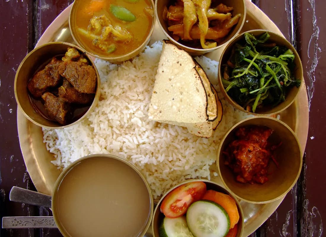 Food
Food Heritage